Software & Processing
WebODM 3.3.0 and COLMAP 4.2.0: What Shipped, Who Upgrades
WebODM 3.3.0 adds Gaussian splat viewing and automatic datum grid downloads. COLMAP 4.2.0 reworks the global mapper, and 4.2.1 already patches it.
Read more →


Tag Archive
18 articles on WebODM. Field-tested methodology from a GIS scientist with M.S. GIS, FAA Part 107, and 10+ years of geospatial work.
WebODM 3.3.0 adds Gaussian splat viewing and automatic datum grid downloads. COLMAP 4.2.0 reworks the global mapper, and 4.2.1 already patches it.
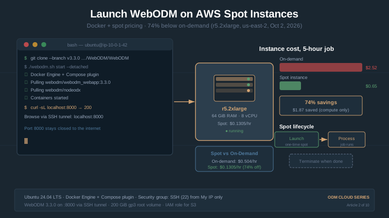
Rent a 64 GB cloud server for about $0.13/hour. Launch an AWS EC2 spot instance, install WebODM 3.3.0, and process 500 images for under $1 before downloads.
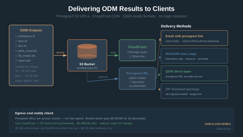
Share WebODM results: S3 presigned URLs, CloudFront CDN, static map hosting, GeoTIFF vs KMZ vs PDF formats, embedding orthomosaics in reports.
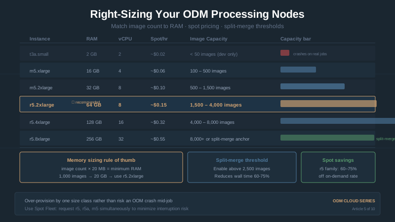
Match AWS EC2 instances to your WebODM image count. RAM is the binding constraint, not CPU. ClusterODX sizing, spot vs on-demand, GPU realities.
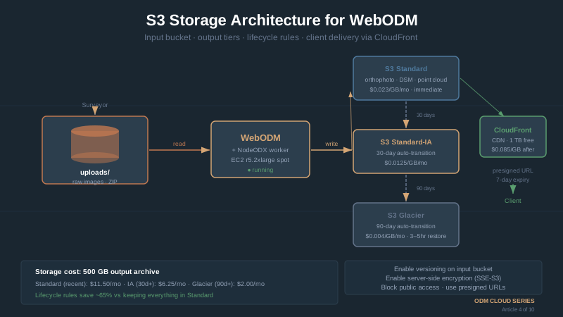
Organize drone images in S3 for WebODM: folder structure, presigned URLs for client delivery, lifecycle policies to control storage costs. CLI included.
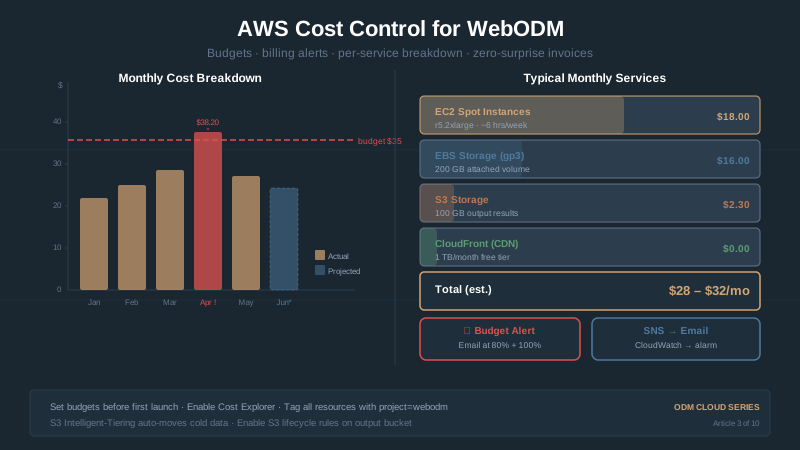
Your first AWS bill says $47.23 when you expected $2. What happened, why egress dominates, and three simple practices to prevent bill shock.
WebODM 3.2.8 adds DXF export for permanent overlays. OpenDroneMap's ODM 3.6.2 fixes a bug that could silently drop GPS telemetry. Two forks, one week — what shipped.
Every ODM processing parameter explained: feature-quality, pc-quality, matcher-type, mesh-size, SMRF, orthophoto-resolution. Three usable presets.
WebODM install guide for Windows, Mac, Linux: Docker setup, first task, hardware requirements, common errors. Free photogrammetry on your hardware.
In April 2026 WebODM forked the OpenDroneMap stack and renamed it — ODM became ODX, NodeODM became NodeODX. Which one you actually install, and why.
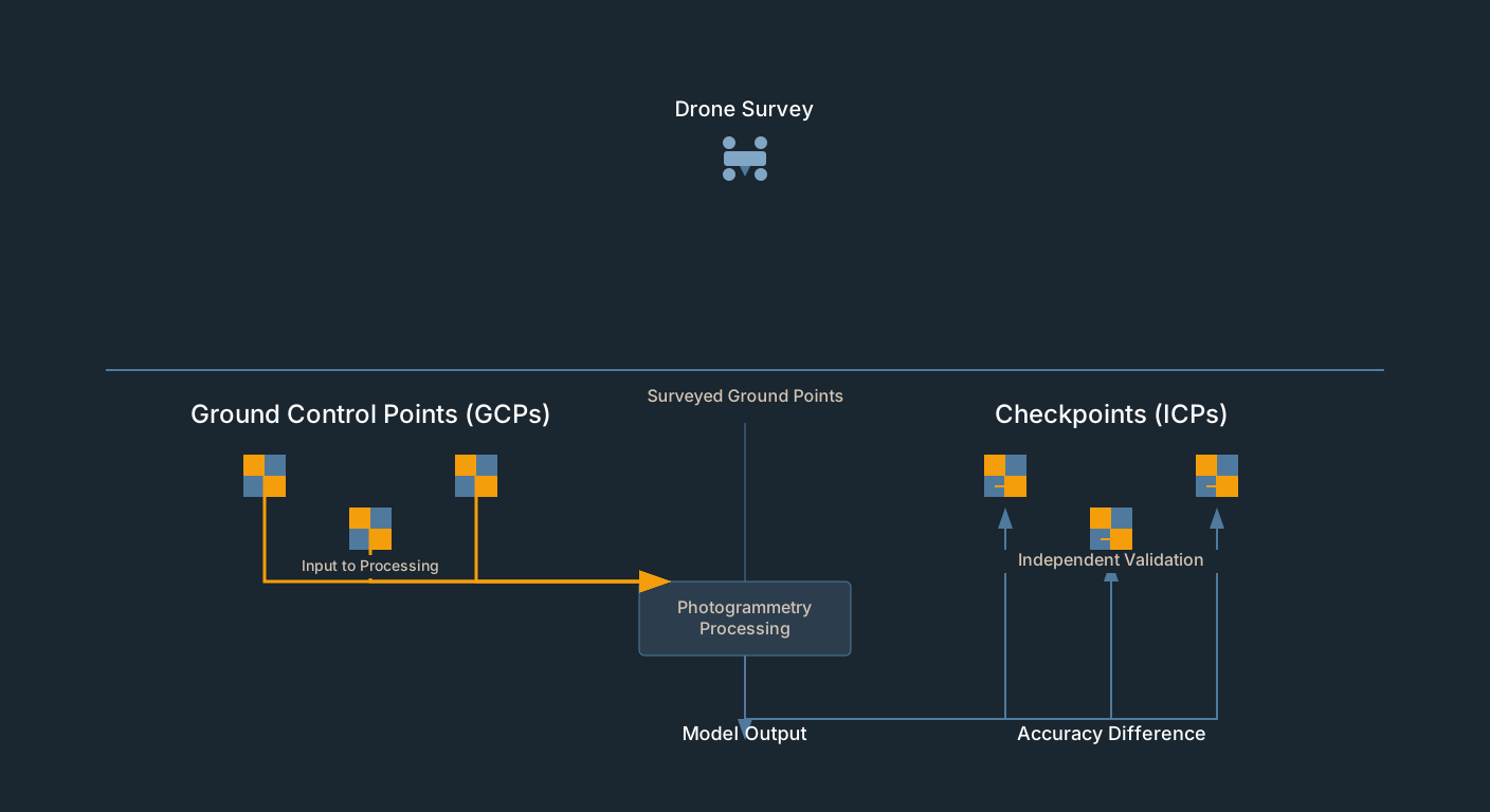
GCP residuals measure fit, not accuracy. Drone survey checkpoints provide independent validation. How to set them up in Pix4D, Metashape, WebODM.
Fly a grid mission with a consumer drone, process a georeferenced orthomosaic in WebODM within 90 minutes. No GCPs, no survey gear, no paid software.
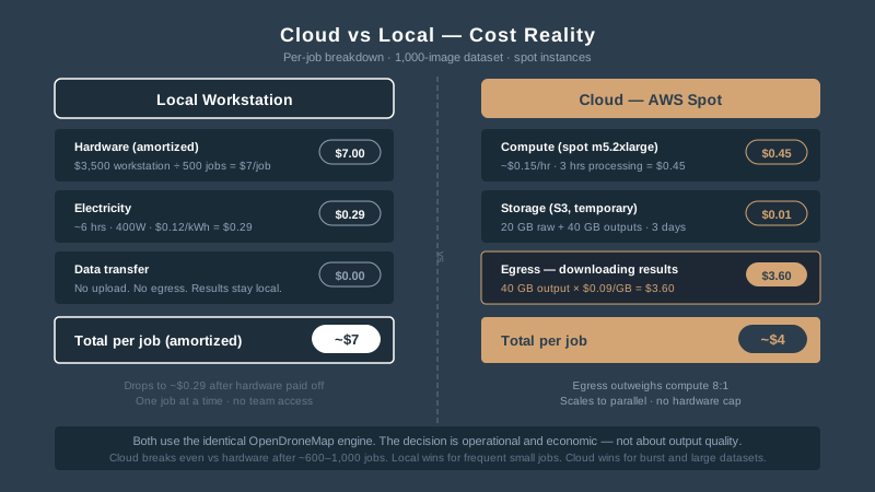
WebODM cloud vs local: AWS spot costs ($3-5/job), egress surprises, decision framework for when cloud wins vs when your workstation is better.
OpenDroneMap, WebODM, NodeODM, ClusterODM and the ODX fork explained: what each does, which you actually need, and how the free stack compares to Pix4D.
WebODM (free) vs Pix4D ($399/mo) for consumer drone mapping: real cost math, WebODM Lightning pricing, orthomosaic quality, and when each is worth it in 2026.
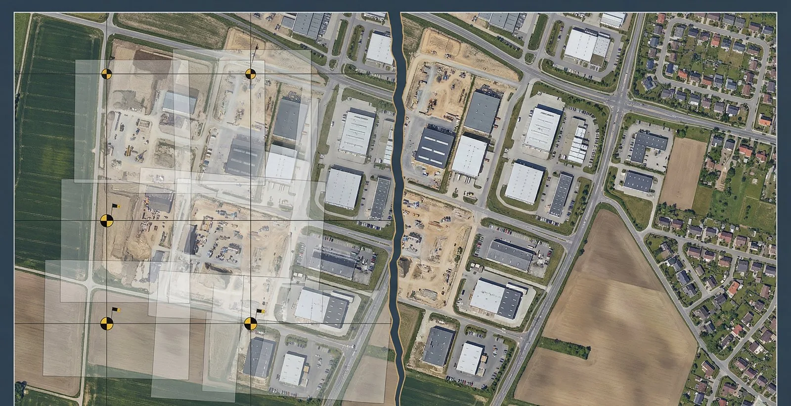
WebODM split from the OpenDroneMap nonprofit on April 6, 2026. What changed, why, and migration steps — new GitHub URLs, Docker images, docs.
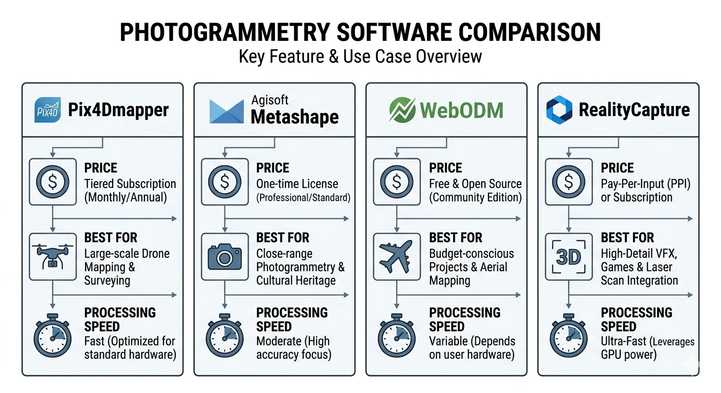
RealityCapture vs Agisoft Metashape vs Pix4D vs WebODM — pricing, speed, accuracy, and GCP workflow compared, and which one wins for survey-grade work in 2026.
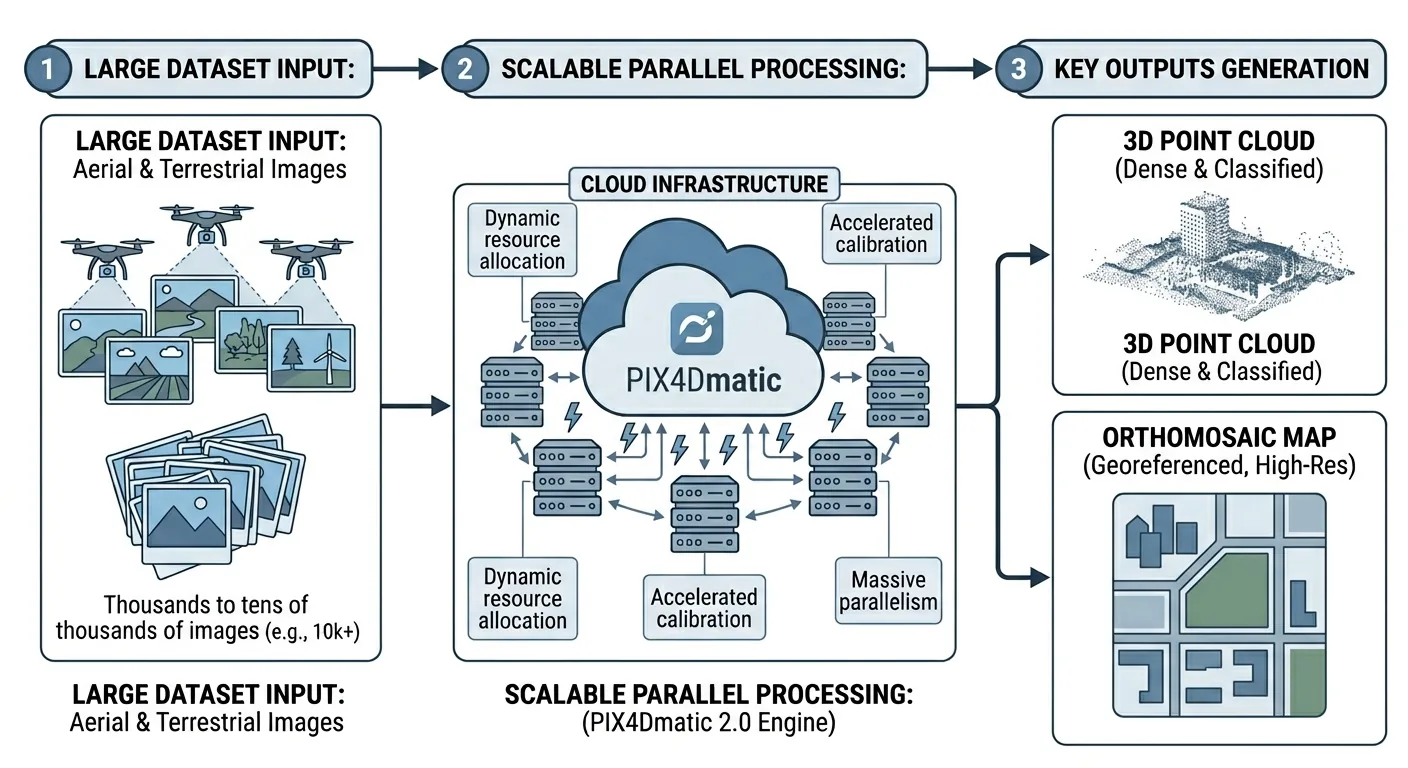
PIX4Dmatic 2.0 absorbs PIX4Dsurvey into three tiers. Full comparison vs Metashape and DJI Terra on price, accuracy, GCP workflows, and deliverables.
Free download: The Complete Drone Mapping Workflow Guide — 30+ pages of field-tested methodology.
Technical content only. Unsubscribe anytime.