


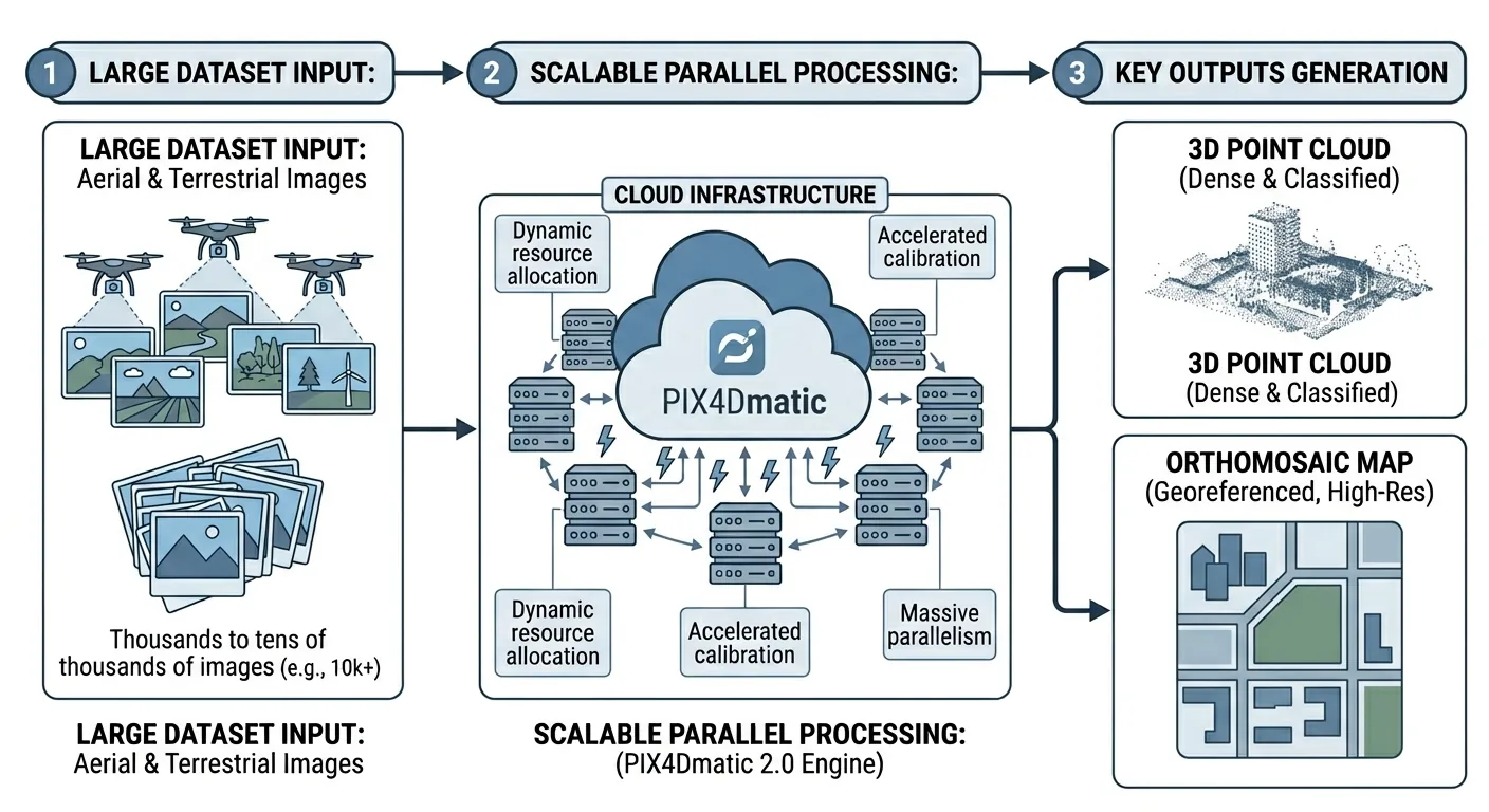
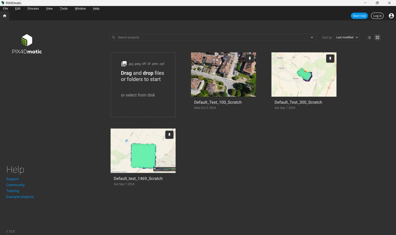
 Image credit: Pix4D. Source: Quick Start Guide — PIX4Dmatic. Used under editorial fair use for product review.
PIX4Dmatic 2.0 went stable on January 5, 2026. It is the biggest architectural change in the product’s history — not because of a single feature, but because Pix4D killed PIX4Dsurvey as a standalone product and folded everything into PIX4Dmatic.
If you were running PIX4Dsurvey for DTM generation, contour lines, or vectorization, that workflow now lives inside PIX4Dmatic 2.0. Your PIX4Dsurvey license? Sunsetted. Your purchasing decision just changed.
This article breaks down what shipped, what it costs, how it compares, and whether the new tier structure makes sense for a working survey operation.
Updated August 22, 2026: the 2.0 merger described below is still the right way to understand why PIX4Dmatic looks the way it does — but the software has moved fast since March. The current version is 2.9.0, tier pricing that was quote-only in March is now public (and the tiers themselves were restructured — see §2), and Gaussian Splatting is no longer PIX4Dcloud-only (see §3). Version-specific details below are marked with what’s changed.
1. What Actually Changed: The PIX4Dsurvey Merger
PIX4Dsurvey handled the post-processing survey pipeline — DTM generation, contour lines, vectorization, volume calculations. PIX4Dmatic handled photogrammetric reconstruction — point clouds, orthomosaics, DSMs. Two products, two licenses, two price tags.
PIX4Dmatic 2.0 absorbs the features of both into a single application. One install, one license, one project file. You open PIX4Dmapper .p4d files and PIX4Dsurvey .p4s files directly.
The merger is not optional, but it’s also not a single cutover date. After January 15, 2026, older versions (1.43 and below) couldn’t log in at all. From there it’s staged: subscriptions and rentals started transitioning to the new plans in January 2026, remaining subscriptions began auto-migrating at renewal starting September 2026, and any stragglers — remaining subscriptions and one-time-charge licenses both — are set to auto-migrate by December 2026. As of this update, that last phase hasn’t happened yet. If you’re still on an old PIX4Dsurvey license, you have a defined runway, not an emergency — but the direction is not in question.
New to PIX4Dmatic. Not new to Pix4D. The company consolidated PIX4Dfields into PIX4Dcatch a few years back. This is the same playbook — reduce product sprawl, push everyone onto one platform, simplify the licensing story.
The version trajectory tells the story: 1.0 launched in 2020, steady incremental releases through 1.86 (December 2, 2025), then the jump to 2.0.0 stable on January 5, 2026.
Pix4D has kept shipping on roughly a monthly cadence since:
- 2.1.0 (Feb 11) — new camera support
- 2.2.0 (Mar 2) — fixed a sparse-point-cloud CRS bug, added multi-TIN/LandXML
- 2.3.0 (Mar 24) — brought Gaussian Splatting to the Pro tier, running locally on your GPU, not just in the cloud
- 2.4.0 (Apr 20) — full vectorization on Gaussian splats, PLY export
- 2.5.x (May–Jul) — stability/security branch
- 2.6.0 (Jun 1) — splatting 30% faster on less VRAM
- 2.7.0 (Jun 22) — rendering backend swapped from OpenGL to Direct3D on Windows and Metal on macOS
- 2.8.0 (Jul 14) — interactive 3D DSM/DTM visualization
- 2.9.0 (Aug 6) — thermal dataset support
As of this update, 2.9.0 is current.
2. The Three-Tier License Structure
PIX4Dmatic ships three tiers: Standard, Analyst, and Pro. Update, August 2026: Pix4D has since put real prices on all three tiers publicly, and restructured what each tier actually includes — Standard and Analyst are no longer a strict “reconstruction, then reconstruction-plus-survey” ladder. Here’s the current structure.
Standard — $332.50/mo or $3,990/yr
Photogrammetric reconstruction: point cloud generation, mesh, DSM, orthomosaic/orthoplanes, georeferencing, and drone/mobile/LiDAR processing in one project. No terrain classification, DTM, contour lines, or CAD vectorization.
Analyst — $190.83/mo or $2,290/yr
Survey and CAD-focused: calibration, point cloud generation, integrated CAD extraction, terrain classification, grid of points, TIN, DTM, contour lines, surface comparison. Notably cheaper than Standard — this is not “Standard plus survey tools” the way it was in March. It’s a parallel tier built around terrain/CAD deliverables rather than full mesh/orthomosaic reconstruction. If your workflow needs both full reconstruction and DTM/contour output, check the current feature list against your workflow before assuming Analyst covers you — Pro is the tier that’s an explicit superset of both.
Pro — $415.83/mo or $4,990/yr
Everything in Standard and Analyst, plus Gaussian Splatting (introduced 2.3.0, running locally on your GPU as of that release — no longer a PIX4Dcloud-only feature, see §3) and a unified project/data model across both workflows. This is the tier that replaces a separate PIX4Dsurvey license cleanly, and the one Pix4D is pushing enterprise/high-volume shops toward.
On perpetual licensing: Pix4D’s public pricing page no longer lists a one-time-purchase option at all — it’s subscription-only on the standard catalog (monthly, annual, or 3-year terms). A “PIX4Dmatic Perpetual License” SKU still shows up through some resellers (one lists CAD $9,799, tier and currency unclear), so it may still exist off-catalog through a sales conversation — but it’s no longer the straightforward, publicly-quoted number the March version of this article described. If perpetual pricing matters to your purchasing decision, get a direct quote rather than trusting any number published online, including this one.
3. Feature Breakdown by Workflow Phase
Here’s what shipped in PIX4Dmatic 2.0 and the 2025 releases leading up to it, organized by where it hits your workflow.
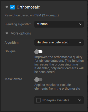 Image credit: Pix4D. Source: Orthomosaic — PIX4Dmatic Documentation. Used under editorial fair use for product review.
Reconstruction
- Point cloud generation from drone imagery — dense matching, automatic filtering
- Orthomosaic generation with the new Orthomosaic Editor (v1.83) — patch-based editing for fixing stitching artifacts, one of the most requested features in the product’s history
- DSM/DTM generation — DSM from the dense point cloud, DTM from ground-classified points (Analyst tier and above)
- Mesh generation with FBX export — useful for BIM handoff and 3D visualization pipelines
- LiDAR import — drag-and-drop LAS/LAZ files, generate mesh/DSM/ortho from LiDAR data directly
Survey Tools (Analyst and Pro)
- Contour lines — you generate contour lines from the DTM. Adjustable interval, exportable to DXF/SHP
- Vectorization — 3-point arcs, circles, breaklines, polylines drawn on the point cloud or orthomosaic
- Image-based vectorization — trace features directly on the source imagery, not just the derived products
- Volume calculations — cut/fill from a base surface, LandXML import for design surfaces
- Road extraction — the software extracts roads and other linear features through the vectorization toolkit. Breaklines snap to the point cloud for clean surface modeling
Export and Delivery
- COG (Cloud-Optimized GeoTIFF) export, which Pix4D advertised as accelerated up to 300x for corridor projects (v1.84) — a massive claimed improvement for linear infrastructure work where the output GeoTIFF can be tens of gigabytes. Verify this figure against Pix4D support directly before relying on it; it wasn’t independently confirmable in current release documentation.
- PIX4Dcloud integration — upload and share via browser, embed in client portals
- Gaussian Splatting — introduced in 2.3.0 (March 24, 2026) for the Pro tier. Update: this is no longer cloud-only. It runs locally on your GPU as of 2.3.0, got a 30% speed boost on lower VRAM in 2.6.0 (June 1), and PIX4Dcloud remains available as an offload option for weaker hardware rather than the only path. Puget Systems recommends an RTX 5080 or better for local splatting workloads.
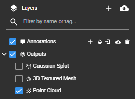 Image credit: Pix4D. Source: Working with Gaussian Splat Models in PIX4Dcloud. Used under editorial fair use for product review.
4. Processing Speed: The Real Numbers
Pix4D claims “up to 50% faster than Mapper.” That claim compares PIX4Dmatic 2.0 to Mapper — which Pix4D sunset years ago. It is technically accurate and practically useless as a benchmark. Nobody shopping for software in 2026 is comparing against a discontinued product.
What matters: PIX4Dmatic 2.0 handles large datasets — 5,000+ images — without the manual block-splitting that Mapper required. The processing pipeline streams data more efficiently, and GPU acceleration on NVIDIA cards (CUDA) makes a measurable difference on dense matching and mesh generation.
Against the actual competition, processing speed sits in the middle of the pack. RealityCapture runs 2-5x faster on equivalent hardware — a gap that widens on larger datasets. Metashape Pro processes at a similar pace to PIX4Dmatic on most workloads. DJI Terra is comparable on DJI-captured imagery but limited to that ecosystem. (For the full four-way breakdown, see Pix4D vs Metashape vs WebODM vs RealityCapture.)
The COG export acceleration Pix4D advertised for v1.84 is the sleeper improvement, if it holds up under your own testing — corridor projects that produced 20+ GB GeoTIFFs used to take hours just to export, and a 300x claimed acceleration on COG generation would cut that to minutes. Confirm the figure on your own dataset before you build a delivery schedule around it.
5. Hardware Reality
PIX4Dmatic 2.0 leans hard on GPU compute. The minimum spec is an NVIDIA GPU with 4 GB VRAM. The practical spec for production work: NVIDIA RTX 3080 or better, 64 GB RAM, NVMe SSD.
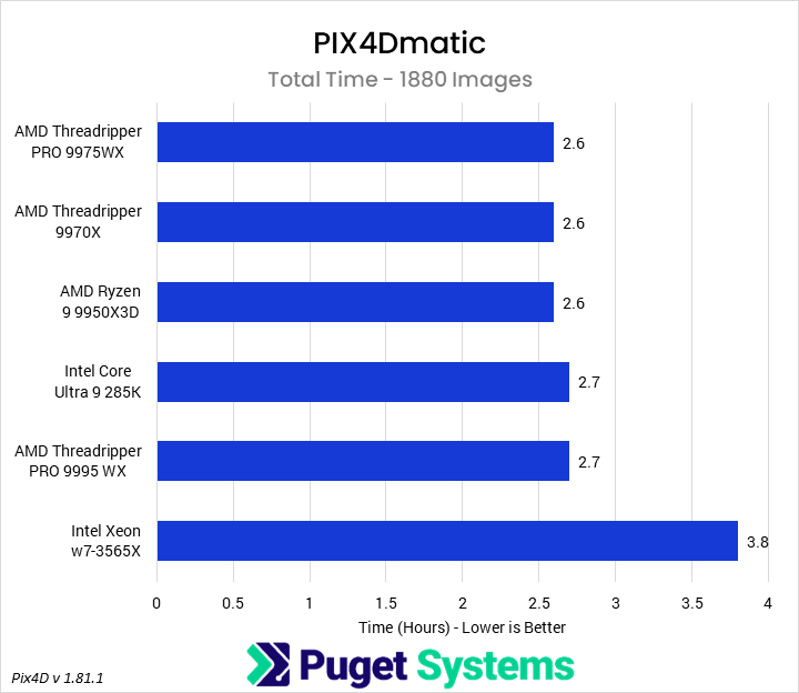 Image credit: Puget Systems. Source: Exploring PIX4Dmatic Hardware Performance. Used under editorial fair use for product review.
GPU Matters More Than CPU
Dense matching and mesh generation scale with CUDA cores. An RTX 4090 cuts processing time roughly in half compared to an RTX 3070 on a 2,000-image dataset. If you’re processing daily, the GPU upgrade pays for itself in weeks.
Intel Arc GPUs got limited support in 2025 builds, but performance is not competitive with NVIDIA. AMD GPUs remain unsupported — no OpenCL fallback, no ROCm path. If your workstation runs AMD graphics, PIX4Dmatic 2.0 falls back to CPU-only processing. That is painfully slow on large datasets.
Mac Performance
Mac users running Apple Silicon see significantly reduced performance. On an M3 Max, a 1,000-image dataset that processes in ~8 minutes on a Windows workstation with an RTX 4090 takes ~12 minutes — roughly 1.5x slower (Puget Systems, 2025). No CUDA, no Metal compute path for the dense matching pipeline. PIX4Dmatic runs on Mac. It does not run well on Mac for production workloads.
Pix4D partnered with Puget Systems as an Official Certified Hardware Provider. The Puget benchmarks are the closest thing to independent hardware testing for PIX4Dmatic — worth checking before speccing a new workstation.
Recommended Production Specs
| Component | Minimum | Recommended | Ideal |
|---|---|---|---|
| GPU | NVIDIA, 4 GB VRAM | RTX 3080, 10 GB (RTX 5080+ if you use Gaussian Splatting) | RTX 4090, 24 GB (RTX 5090 for splatting workloads) |
| RAM | 16 GB | 64 GB | 128 GB |
| Storage | SSD | NVMe, 1 TB | NVMe, 2+ TB |
| CPU | Intel i7 / Ryzen 7 | Intel i9 / Ryzen 9 | Threadripper / Xeon |
| OS | Windows 10/11 | Windows 11 | Windows 11 |
6. User Experience: What Works and What Doesn’t
What works
The UI is cleaner than Mapper. Project setup is faster — importing imagery, setting the coordinate reference system, and kicking off processing takes fewer clicks. For operators who spent years in Mapper’s dated interface, the difference is immediately noticeable.
The Orthomosaic Editor alone justifies the upgrade for many users. Stitching artifacts that required exporting to Photoshop or GIMP for manual patch work now get fixed inside PIX4Dmatic. Select the problem area, choose a source image, blend. The community forum feedback on this feature is overwhelmingly positive — it solves a problem every operator has dealt with on projects near water, moving objects, or variable lighting.
Opening legacy .p4d and .p4s project files works. Migration from existing Mapper and PIX4Dsurvey projects is functional — not seamless, but functional. Expect to verify your CRS settings and recheck GCP placement on imported projects.
Sensor support covers the major platforms: DJI Mavic 3 Pro/3E, Matrice 300 RTK with Zenmuse P1, Matrice 4/4T, Autel EVO II series, Skydio X2/X10, WingtraOne, and senseFly eBee X. If you fly mainstream commercial drones, your imagery processes without drama.
What doesn’t
The black box problem. PIX4Dmatic offers fewer processing parameter controls than Mapper or Metashape. You get quality presets — not granular control over matching parameters, filtering thresholds, or reconstruction density. Experienced users who tuned Mapper settings for specific terrain types or challenging conditions lose that control. One community forum user put it bluntly: “Too much of a black box with very few processing options.”
Quality reports lag behind Mapper. The processing report in PIX4Dmatic 2.0 does not match Mapper’s detail level. Reprojection error, GCP residuals by axis, checkpoint validation and RMSE reporting, camera optimization statistics — Mapper’s quality report PDF remains the industry standard for defensible accuracy documentation. PIX4Dmatic’s report is improving but not there yet. If your clients or agencies require a detailed quality report PDF, verify that PIX4Dmatic’s output meets their requirements before switching.
Export limitations. PIX4Dmatic’s export options are narrower than Mapper’s. No 3D PDF export, for one. If your deliverable workflow depends on specific export formats, check compatibility before committing.
Known bugs. Version 2.0 shipped with a sparse point cloud CRS mismatch bug, confirmed fixed in 2.2.0 (the release notes describe fixing “the scene origin was not recentered when changing the CRS for imported images”). A point cloud export misalignment issue was reported around the 2.2.0 timeframe (March 2026) with no public fix confirmed since — treat it as last-known-open rather than assume it’s resolved, and check the Pix4D community forum for current status before committing to a production workflow. Random crashes on Windows 11 have been reported in connection with OneDrive sync, aggressive antivirus scanning, and outdated GPU drivers.
Missing capabilities — updated. As of 2.9.0 (August 6, 2026), PIX4Dmatic added support for thermal datasets (FLIR/DJI radiometric imagery, processed into georeferenced 2D thermal orthomosaics) — the “RGB-only” limitation from earlier versions no longer holds for thermal. Multispectral processing is still not supported; that remains PIX4Dfields or Metashape territory. No native PPK workflow or batch geotag import from text files, as of this writing.
7. Competitive Positioning: Honest Comparison
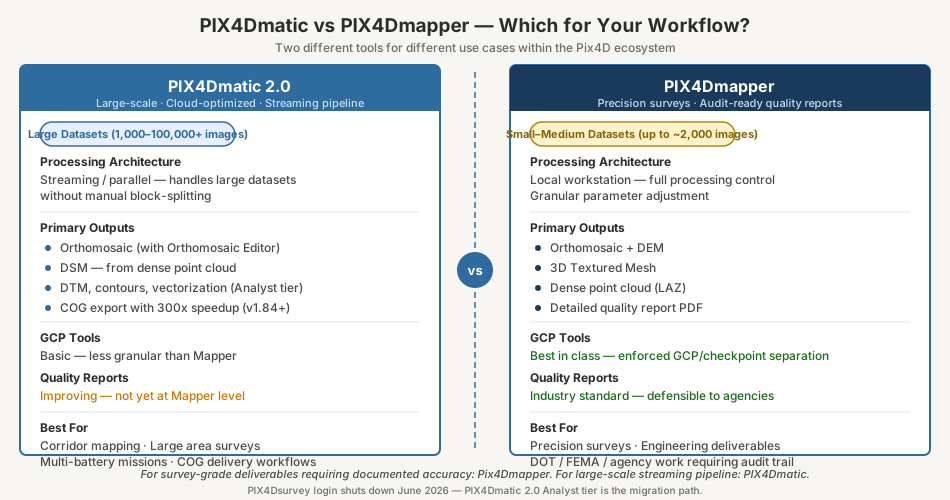
PIX4Dmatic 2.0 does not exist in a vacuum. The market shifted significantly in 2024-2025, and the purchasing decision depends on what you fly, what you deliver, and how much you process.
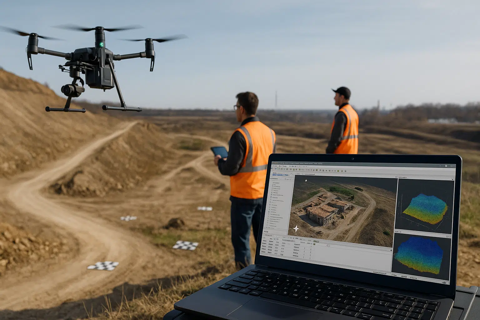 Image credit: Agisoft LLC. Source: Agisoft Metashape Professional Edition. Used under editorial fair use for product review.
| Software | Best For | Annual Cost (Solo Surveyor) | Survey-Grade Deliverables | Perpetual Option |
|---|---|---|---|---|
| PIX4Dmatic Pro | Large datasets, integrated survey pipeline | $4,990/yr | Yes | Off-catalog only (reseller quote) |
| Agisoft Metashape Pro | Maximum control, Python automation, long-term value | $3,499 one-time | Yes | $3,499 |
| DJI Terra (Standard tier, renamed from “Pro” in 2025) | DJI-only fleets, integrated LiDAR | Reseller quote — DJI enforces MAP pricing, publicly-advertised figures aren’t reliable | Yes with RTK | No |
| RealityCapture | Speed, 3D scanning, VFX | Free (<$1M revenue) / $1,250/yr | Limited | No |
| WebODM | Budget, data sovereignty, pipeline automation | Free (self-hosted) | Possible with GCPs | N/A |
| 3Dsurvey | Multi-source survey workflows | ~$2,700/yr | Yes | Yes (~$4,100 one-time) |
The Metashape math
Metashape Pro perpetual license: $3,499, unchanged since March. PIX4Dmatic no longer features a perpetual option on its public pricing page at all — the cleanest comparison now is Metashape’s $3,499 one-time cost against PIX4Dmatic Pro’s $4,990/yr subscription, which means Metashape breaks even in well under a year and keeps compounding as a savings from there. If you specifically need PIX4Dmatic’s survey toolset or ecosystem, that gap doesn’t disappear — it’s the price of the ecosystem, not something to negotiate away. Metashape also offers Python scripting that PIX4Dmatic lacks — a real differentiator for shops automating batch processing.
The tradeoff: Metashape’s quality report is good but not as structured as Pix4D’s. The checkpoint workflow requires more manual setup. And Agisoft is a Russian-owned company — increasingly problematic for US federal and DoD contracts.
The DJI Terra question
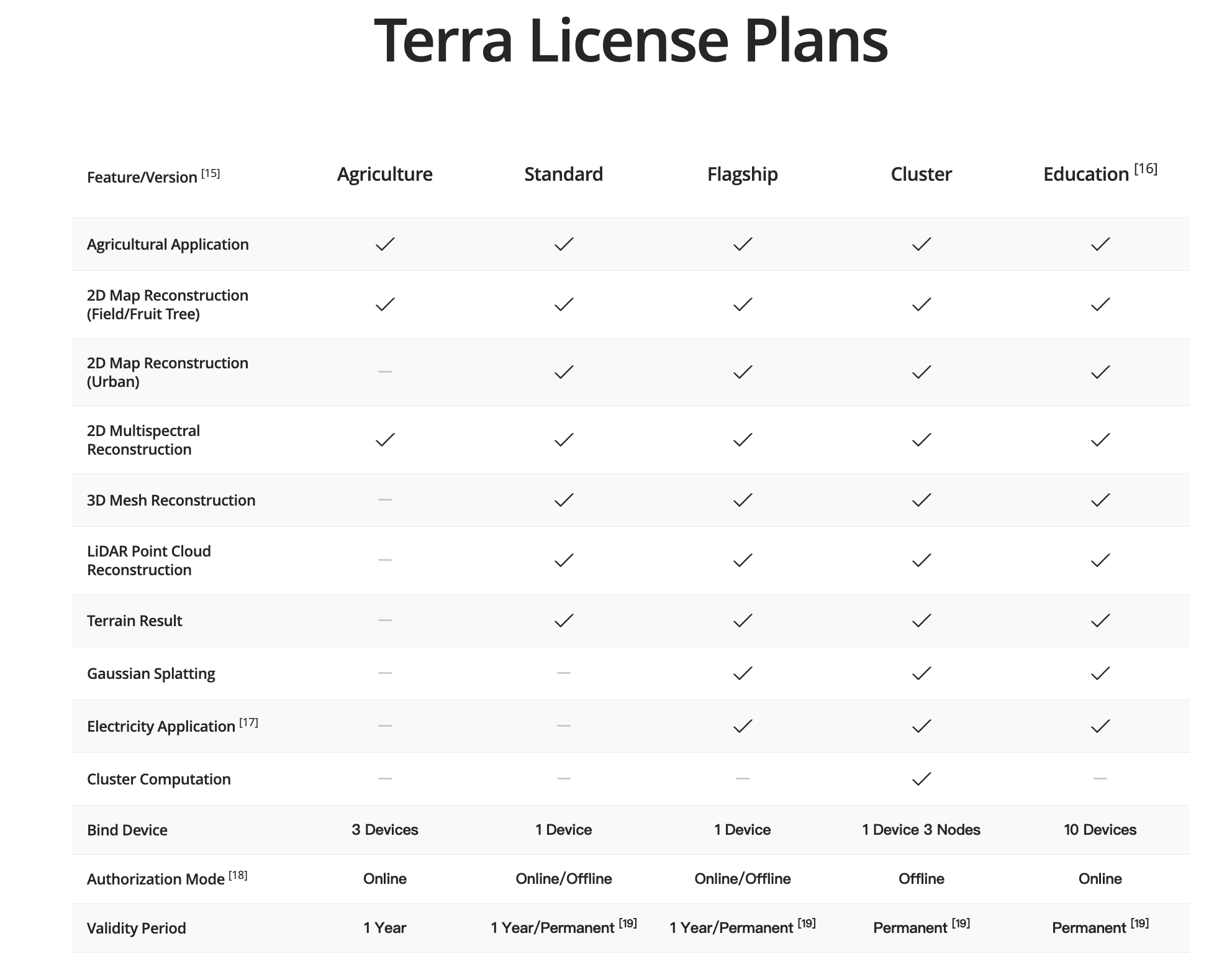 Image credit: DJI. Source: DJI Terra V5.1 Release. Used under editorial fair use for product review.
DJI renamed Terra’s tiers in 2025 — what this article originally called “Terra Pro” is now called “Standard.” DJI enforces minimum advertised pricing (MAP), so there’s no single reliable public number to quote; reseller pricing found for the current Standard tier ranged from roughly $1,000 to $1,300/yr, but get a direct quote rather than trusting any published figure, including the old one here. It integrates tightly with DJI hardware — Matrice 300/350 RTK, Zenmuse P1/L2, Mavic 3 Enterprise. For DJI-only fleets doing straightforward mapping, it remains the lowest-friction option regardless of the exact price.
The catch: DJI is Chinese-owned. Terra is banned or restricted on many US federal projects. If you fly mixed fleets or work federal contracts, Terra is not an option regardless of price.
The RealityCapture disruption
Epic Games made RealityCapture free for operations under $1M annual revenue (April 2024). That blew open the entry-level market. Processing speed is 2-5x faster than PIX4Dmatic or Metashape on equivalent hardware. For 3D reconstruction — heritage, inspection, BIM — RealityCapture is hard to beat.
For survey-grade GIS deliverables with documented accuracy, RealityCapture’s GCP workflow and quality reporting trail Pix4D and Metashape. It can produce orthomosaics and point clouds, but the accuracy documentation you need for engineering clients requires manual assembly outside the software.
The WebODM factor
WebODM costs nothing to self-host and produces checkpoint RMSE competitive with commercial platforms on well-configured datasets with proper GCPs. Published research — including studies in ISPRS Annals — shows ODM within 0.06-0.1 feet of Pix4D and Metashape on controlled datasets. The gap: no structured quality report, no integrated checkpoint validation, more fragile on marginal data. For operators building automated pipelines on dedicated hardware, WebODM delivers real cost savings. For client-facing work requiring formal accuracy documentation, it adds manual overhead.
8. The Licensing Controversy
The biggest user complaint about PIX4Dmatic 2.0 is not technical. It is strategic.
Pix4D locked the former PIX4Dsurvey toolset — DTM, contour lines, vectorization — behind the Analyst tier. AI-assisted features sit behind Pro. Users who paid for PIX4Dsurvey as a standalone product now face an upgrade to Analyst just to keep capabilities they already had.
From the Pix4D community forum: “Very disappointed to see that Pix4D Survey features, along with AI enhancements are locked behind the Pix4D Matic ‘Pro’ tier.”
Pix4D’s pricing is competitive. The real question: do you need the integrated survey toolset, or can you get the same deliverables from Metashape Pro at a fraction of the cost?
If your workflow depends on the Pix4D quality report format, the .p4d project ecosystem, and PIX4Dcloud for client delivery — Analyst is defensible. The integration saves enough pipeline friction to justify the premium.
If you process orthomosaics and point clouds without needing Pix4D’s specific report format, Metashape Pro at $3,499 perpetual delivers comparable accuracy with more processing control and no annual renewal.
9. Ecosystem Play: Partnerships and Integrations
Pix4D made several ecosystem moves in 2025 that signal where the product is headed. The strategy is clear: build an end-to-end pipeline from flight planning through client delivery, all inside the Pix4D ecosystem.
-
Puget Systems — Official Certified Hardware Provider. Puget publishes PIX4Dmatic benchmarks on their workstation configurations. The partnership gives Pix4D a credible hardware recommendation channel and gives buyers validated performance data before purchasing. If you are building or buying a processing workstation, the Puget benchmark database is the best resource for real-world PIX4Dmatic performance numbers.
-
SPH Engineering (UgCS) — Pix4D partnered with SPH Engineering, the Latvia-based company behind UgCS flight planning software. The integration connects mission planning in UgCS directly to processing in PIX4Dmatic. For operators flying complex missions — corridor surveys, terrain-following, multi-battery operations — the tighter handoff between planning and processing reduces manual file management. Flight plans, camera trigger logs, and GPS data flow from UgCS into PIX4Dmatic without manual reformatting.
-
Esri ArcGIS — PIX4Dmatic outputs (orthomosaics, point clouds, DSMs) integrate with ArcGIS Pro and ArcGIS Online. COG export is particularly useful here — Cloud-Optimized GeoTIFFs load efficiently in ArcGIS Online without preprocessing. For GIS shops already in the Esri ecosystem, the PIX4Dmatic-to-ArcGIS pipeline is clean.
-
Drone Harmony — Flight planning integration for automated mission execution. Drone Harmony focuses on inspection and vertical-structure missions — facades, towers, infrastructure. The integration connects that specialized flight planning directly to PIX4Dmatic processing.
-
PIX4Dcloud — Pix4D’s own cloud platform handles sharing, collaboration, measurement, and Gaussian Splatting rendering. The cloud tier bundles with Pro licenses. For firms delivering to non-technical clients who need browser-based access to drone data, PIX4Dcloud is the built-in answer. Clients can measure distances, annotate maps, and share links without installing anything. Whether PIX4Dcloud is better than standalone platforms like DroneDeploy’s viewer or Nearmap depends on your client base and how deep into the Pix4D ecosystem you want to go.
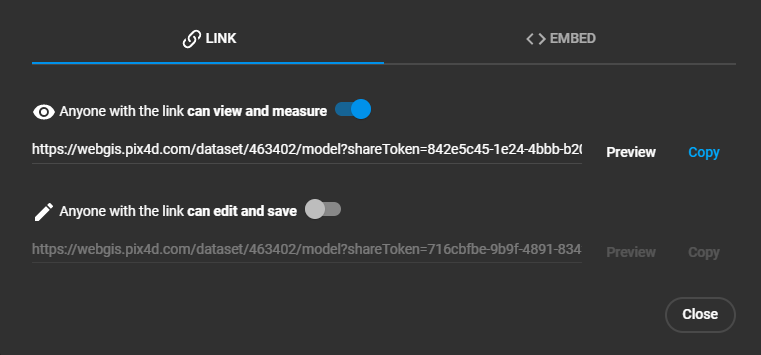 Image credit: Pix4D. Source: Share functionality — PIX4Dcloud. Used under editorial fair use for product review.
The ecosystem play matters because it creates switching costs. The more of your pipeline that runs through Pix4D — flight planning, processing, cloud delivery, client access — the harder it becomes to move to Metashape or another platform. That is by design. Evaluate the ecosystem value honestly: if you use three or more of these integrations, the lock-in may be worth the premium. If you only use PIX4Dmatic for desktop processing, the ecosystem adds nothing and the cost comparison favors alternatives.
10. Bottom Line: Who Should Buy, Who Should Wait, Who Should Look Elsewhere
Buy PIX4Dmatic Pro if:
- You were running both PIX4Dmatic and PIX4Dsurvey and need the fully consolidated workflow — Pro is the tier that’s an explicit superset of both, per Pix4D’s current tier breakdown (see §2)
- Your clients require Pix4D-format quality reports and you deliver through PIX4Dcloud
- You process large datasets (3,000+ images) regularly and need the streaming pipeline
- You fly DJI and non-DJI hardware on a Windows workstation with an NVIDIA GPU
- You already depend on the Pix4D ecosystem for client delivery
Consider Standard or Analyst instead if your workflow only needs one side of the split — full reconstruction without terrain/CAD tools (Standard), or terrain/CAD deliverables without needing Pro’s Gaussian Splatting and unified data model (Analyst). Check the current feature lists against your actual workflow; the two are no longer a simple “basic vs. basic-plus-survey” ladder.
Wait if:
- You need multispectral processing — PIX4Dmatic still doesn’t support it (thermal is now supported as of 2.9.0, August 2026)
- You need granular processing controls — the black box design may not suit your workflow
- You’re deciding based on perpetual-license cost — get a direct reseller quote first; it’s no longer a public catalog price
Look elsewhere if:
- You want perpetual licensing at a reasonable, publicly-quoted price — Metashape Pro at $3,499 one-time beats negotiating for an off-catalog PIX4Dmatic quote
- You need Python scripting and batch automation — Metashape’s API is far ahead
- You fly DJI-only and work non-federal projects — DJI Terra’s current Standard tier (renamed from “Pro”) does the job for less, though get a reseller quote since DJI doesn’t publish a reliable price
- Your revenue is under $1M and speed is your bottleneck — RealityCapture is free and 2-5x faster
- You want full control over your processing pipeline — WebODM on dedicated hardware gives you that at zero software cost
To put it plainly: PIX4Dmatic is a better product than the pre-2.0 line, and it hasn’t stood still since — the PIX4Dsurvey merger is well underway with a hard December 2026 deadline for stragglers, pricing that was quote-only in March is now public, and Gaussian Splatting moved from cloud-only to local GPU. The three-tier licensing still makes sense for Pix4D’s business. Whether it makes sense for yours depends on how much of the Pix4D ecosystem you actually use — and whether that ecosystem lock-in is worth the premium over alternatives that deliver comparable accuracy at lower cost.
This article was originally published March 2026 and updated August 22, 2026 to reflect the current PIX4Dmatic version (2.9.0), current public tier pricing, and the actual (still in-progress) PIX4Dsurvey migration timeline. Pricing, features, and availability change — verify current details at pix4d.com before making purchasing decisions. For our full professional-reliance disclaimer, see /disclaimer.