
Photogrammetry
Point Cloud Classification: Ground, Vegetation & Buildings
Classify drone point clouds into ground/vegetation/buildings with Metashape, LAStools, PDAL, CloudCompare, ArcGIS Pro. Tool decision framework.
Read more →
Tag Archive
9 articles on Metashape. Field-tested methodology from a GIS scientist with M.S. GIS, FAA Part 107, and 10+ years of geospatial work.
Classify drone point clouds into ground/vegetation/buildings with Metashape, LAStools, PDAL, CloudCompare, ArcGIS Pro. Tool decision framework.

A practitioner's guide to Agisoft Metashape processing settings: what each quality slider controls, why the tradeoffs matter, and three presets for real jobs.
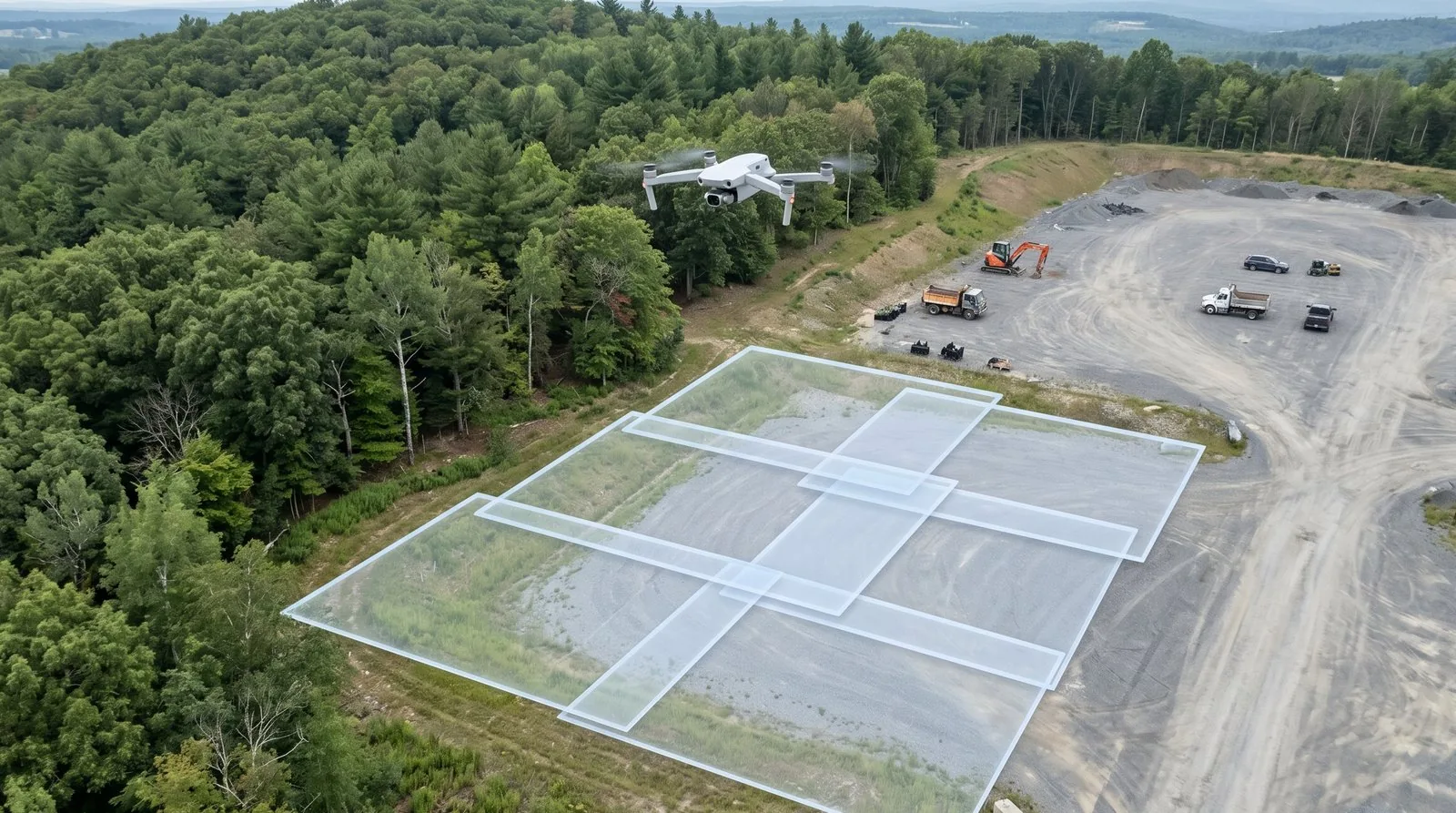
Image overlap drone mapping: 75/60 is the floor, not the target. Here's what fails when overlap is wrong and how to set photogrammetry overlap by job type.

The drone mapping quality report looks reassuring — until a client finds 8-inch errors. Learn to read every Pix4D and Metashape number before delivery.

GCP residuals measure fit, not accuracy. Drone survey checkpoints provide independent validation. How to set them up in Pix4D, Metashape, WebODM.

WGS84 vs NAD83, state plane, vertical datums — the CRS settings drone operators get wrong, and how to fix them in Metashape, Pix4D, and ODM.
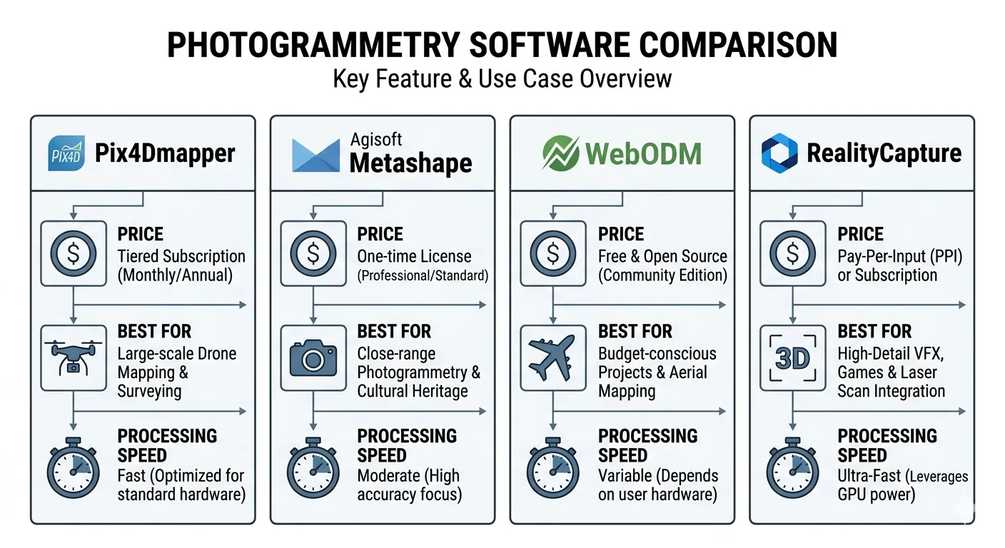
WebODM vs Pix4D vs Metashape vs RealityCapture: pricing, speed, accuracy, and GCP workflow compared — and which one wins for survey-grade work in 2026.
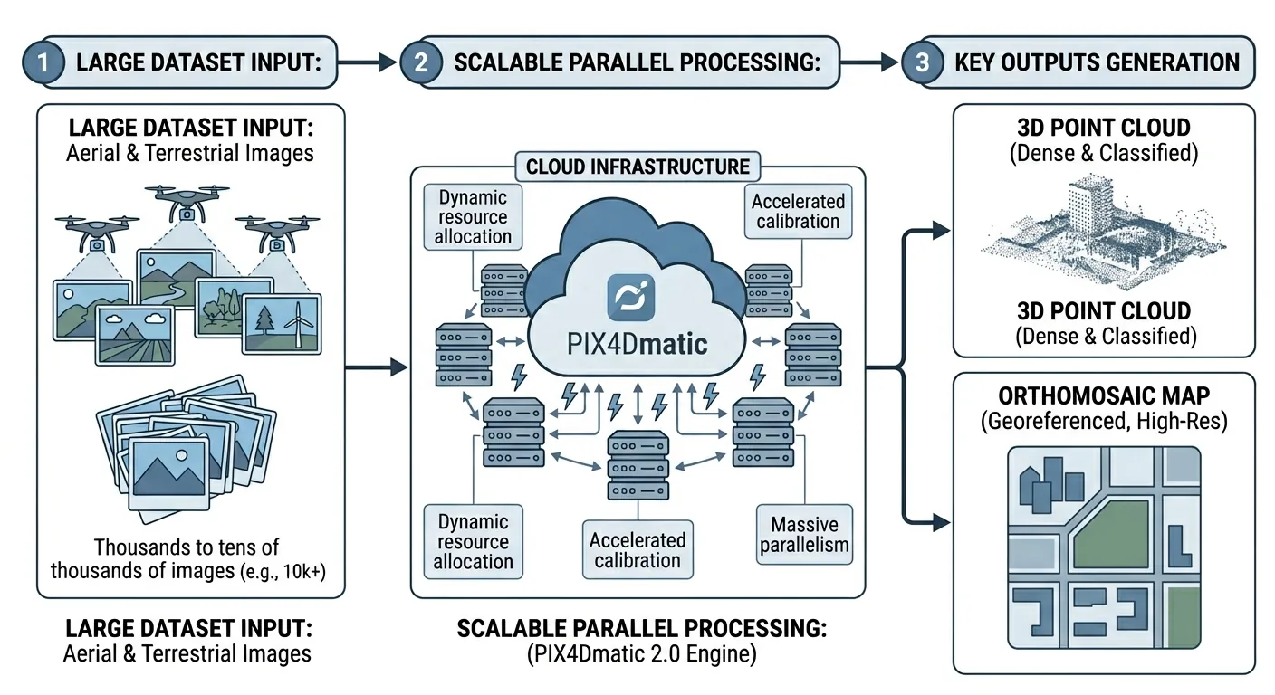
PIX4Dmatic 2.0 absorbs PIX4Dsurvey into three tiers. Full comparison vs Metashape and DJI Terra on price, accuracy, GCP workflows, and deliverables.
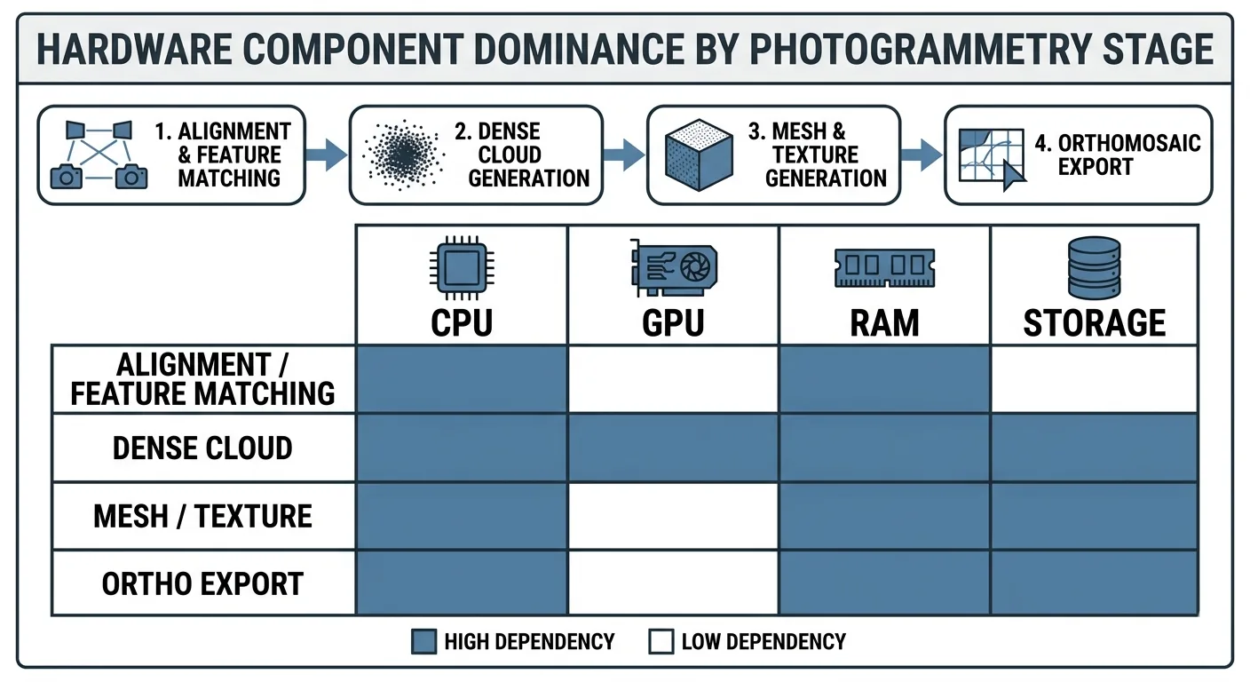
Drone mapping hardware guide: CPU, GPU, RAM, NVMe requirements for photogrammetry. Workstation builds by project size and processing software.
Free download: The Complete Drone Mapping Workflow Guide — 30+ pages of field-tested methodology.
Technical content only. Unsubscribe anytime.