
Photogrammetry Workflow Guide
How to Create a Georeferenced NeRF from Drone Imagery
Build georeferenced NeRFs from drone imagery: RTK/PPK integration, COLMAP geo-registration, Nerfstudio, point cloud export, checkpoint validation.
Read more →


Tag Archive
5 articles on PPK. Field-tested methodology from a GIS scientist with M.S. GIS, FAA Part 107, and 10+ years of geospatial work.
Build georeferenced NeRFs from drone imagery: RTK/PPK integration, COLMAP geo-registration, Nerfstudio, point cloud export, checkpoint validation.

BVLOS for mapping: where proposed Part 108 stands as of October 2026, the waiver process, equipment, PPK workflows, and corridor crew-savings math.
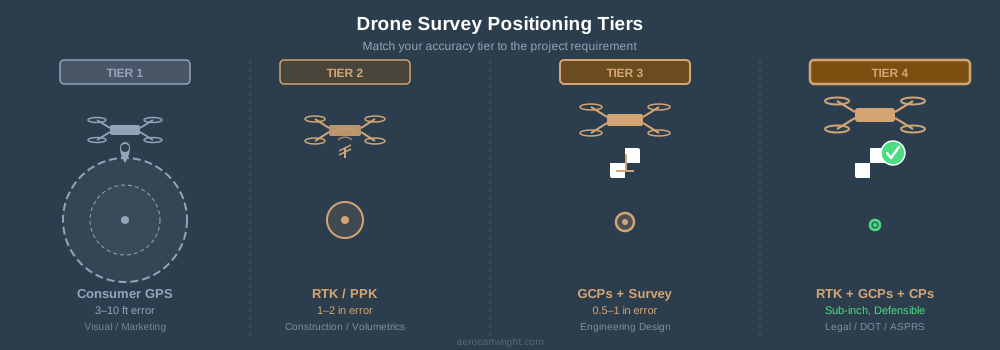
Four positioning tiers for drone surveys: GPS, RTK/PPK, GCPs, and full RTK+GCPs+checkpoints. Match accuracy to the job — not every project needs the top tier.
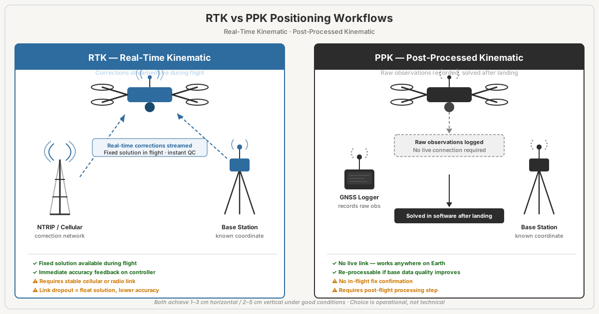
RTK vs PPK for drone mapping: same hardware, different timing. Sourced accuracy figures, baseline limits, costs, and a table for when to use each.
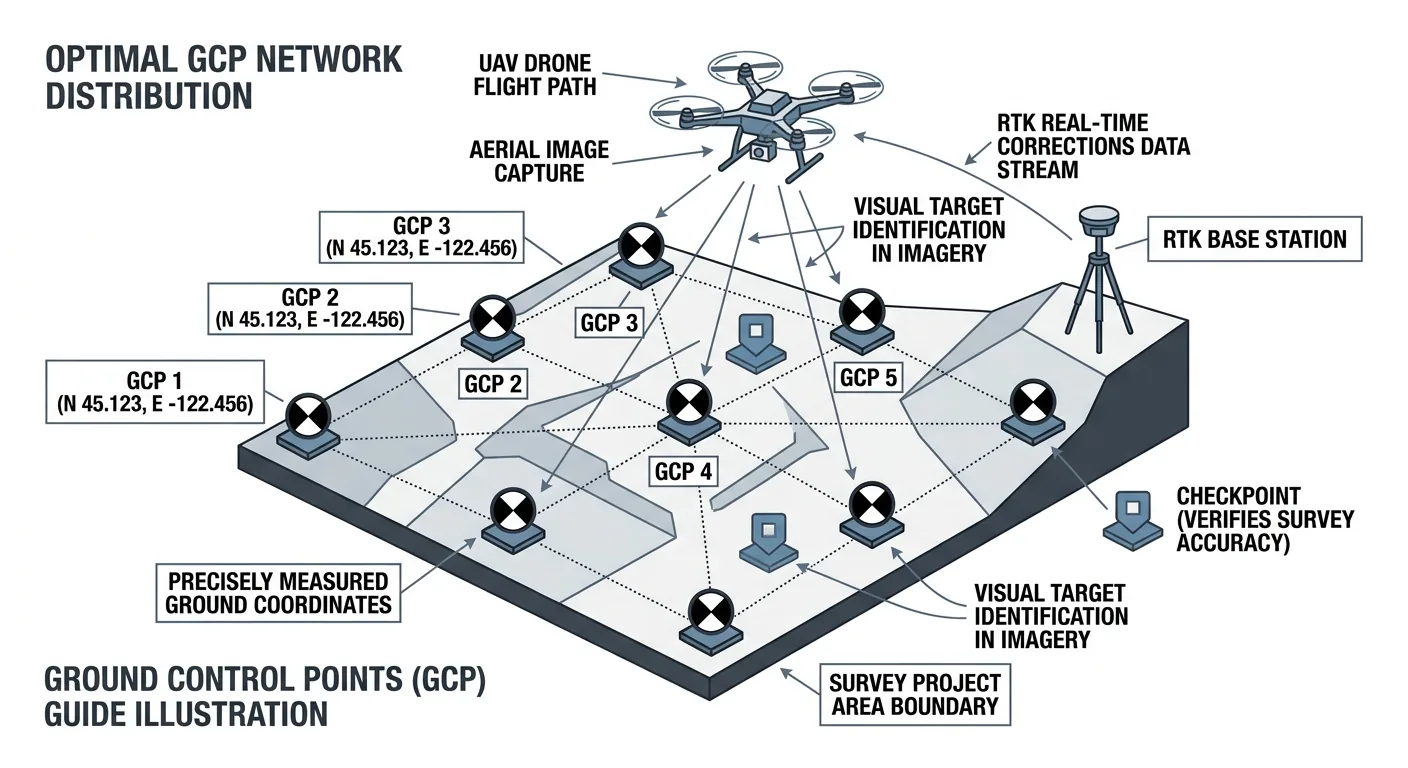
How many ground control points does a drone survey need? 5 GCPs for under 5 acres, 8–12 for 50–500. Distribution beats density — and always include independent checkpoints.
Free download: The Complete Drone Mapping Workflow Guide — 30+ pages of field-tested methodology.
Technical content only. Unsubscribe anytime.