ODM Cloud
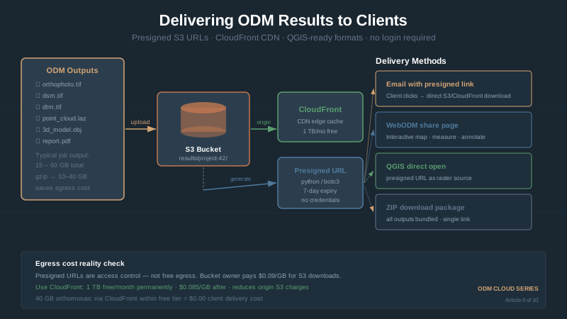
Sharing Results: From WebODM to Client Map Link
Share WebODM results: S3 presigned URLs, CloudFront CDN, static map hosting, GeoTIFF vs KMZ vs PDF formats, embedding orthomosaics in reports.
Read more →


Tag Archive
6 articles on GIS. Field-tested methodology from a GIS scientist with M.S. GIS, FAA Part 107, and 10+ years of geospatial work.
Share WebODM results: S3 presigned URLs, CloudFront CDN, static map hosting, GeoTIFF vs KMZ vs PDF formats, embedding orthomosaics in reports.
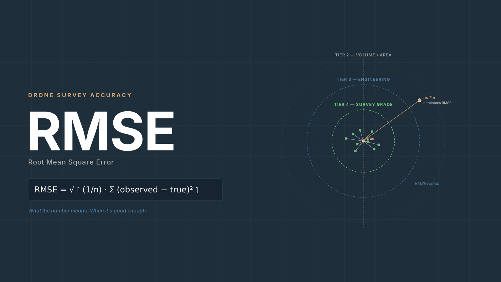
RMSE drone mapping explained: what the formula means, why vertical is always worse, CE90/LE90 conversions, NSSDA statements, when it's good enough.
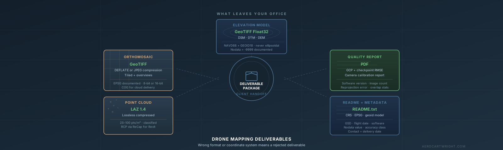
Orthomosaic export settings, point cloud formats, DEMs, coordinate systems — and how to package drone deliverables so clients can actually use them.

Drone data in ArcGIS Pro: import orthomosaics, point clouds, DSMs. Workflow to volume calculations, contours, and ArcGIS Online delivery.
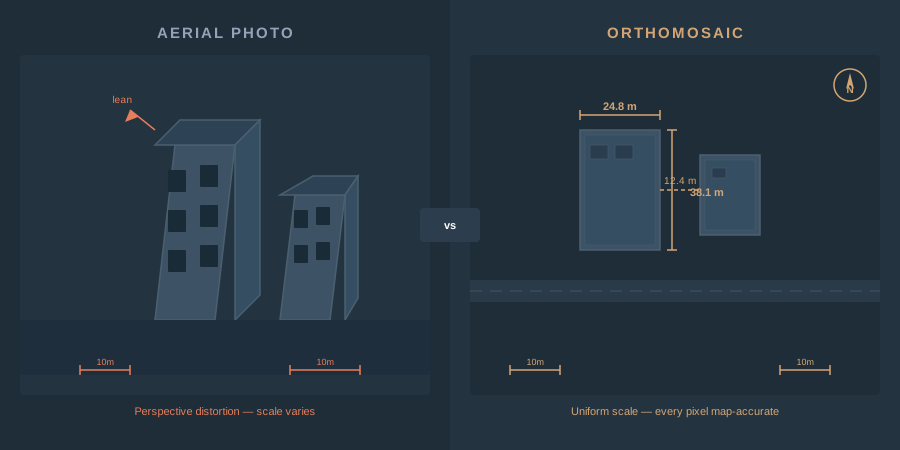
An orthomosaic is a georeferenced image mosaic built from overlapping drone photos. How photogrammetry creates one, GSD, GeoTIFF vs COG, GIS use.
AeroCartwright: drone mapping education and geospatial tools from a working GIS professional with firefighting, academic, and federal field experience.
Free download: The Complete Drone Mapping Workflow Guide — 30+ pages of field-tested methodology.
Technical content only. Unsubscribe anytime.