

You’re standing in a construction site at 6 AM. The client is flying in at noon to see the latest progress. You have a photogrammetric orthomosaic and point cloud from yesterday’s flight — sharp, accurate, exactly 3.5 cm horizontal RMSE. But when you hand the client a textured mesh, it’s choppy. Jagged polygons. Texture popping. The client squints at their laptop and says, “Show me something I can actually walk through in 3D without it looking like a 2003 video game.”
That’s where 3D Gaussian Splatting comes in. Same flight data. Two hours later, you hand them a photorealistic, real-time interactive 3D walkthrough rendered at 60 frames per second. No polygon artifacts. No texture seams. Photorealistic appearance from every angle.
This isn’t NeRF hype. It’s not theoretical. DJI shipped native 3DGS in Terra v5.0 in July 2025. Pix4D integrated georeferenced splatting in Pix4Dcloud last fall. OpenSplat — created by Piero Toffanin, the founder of OpenDroneMap — now reads camera poses directly from WebODM pipelines. Contractors, real estate firms, and heritage documentation projects are using this right now.
Here’s the bottom line: 3D Gaussian Splatting is not a replacement for photogrammetry. It’s an augmentation. Same images, same flight plan, different pipeline. One produces measurement deliverables. The other produces visualization deliverables. If you’re not offering both, you’re leaving money on the table.
Drone mapping workflows have evolved steadily for years. Since late 2024, published 3DGS pipelines have been tested on real project data — training times, accuracy, outputs, and what clients actually want. Here’s what the research papers get right, what they oversell, and what it means for your business.
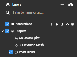
What 3D Gaussian Splatting Actually Is
A 3D Gaussian Splat is an ellipsoidal blob — a 3D Gaussian distribution with position, orientation, opacity, and color. Train a model on overlapping drone images, and it optimizes millions of these blobs to reconstruct the scene’s appearance. That’s it. That’s the core insight.
The foundational paper — Kerbl et al. (2023, ACM SIGGRAPH, 3D Gaussian Splatting for Real-Time Radiance Field Rendering) describes the method clearly. You start with a sparse point cloud from Structure-from-Motion. You instantiate a 3D Gaussian splat at each point. Then you optimize: run forward passes where the splatting engine renders each Gaussian to the image plane, compute the difference between rendered and observed pixels, backpropagate errors through a differentiable rasterizer (not ray-marching, unlike NeRF), and update positions, rotations, colors, and opacities.
The differentiable rasterizer is the magic. Traditional rendering of Gaussians would be prohibitively slow. NeRF-style volumetric rendering — sampling a ray hundreds of times through a neural field — is even slower. The rasterization approach (direct splat-to-pixel projection) delivers 60+ fps on consumer GPUs. NeRF renders at roughly one frame per 22 seconds. That’s 1,320x faster.
Colors are stored in spherical harmonic coefficients (not raw RGB), which means the model learns view-dependent appearance — a tree looks different from the side than from above because the harmonics capture directional shading. Point opacity is learned too, so the optimizer can make distant or occluded regions transparent rather than forcing them to solid color.
Training converges in 35-45 minutes (30,000 iterations) on an RTX 4090 with 200-500 images. Preview quality — good enough to show a client — appears at iteration 7,000, roughly 10 minutes of wall-clock time. That’s why DJI integrated this into Terra: the speed advantage over NeRF makes interactive iteration feasible within a production workflow.
Key constraint: 3DGS optimizes visual fidelity, not geometry. It learns appearance — how light reflects, how colors vary with view angle, where transparent regions exist. The “3D” part comes from Gaussian positions, but those positions are optimized for rendering quality, not geometric accuracy. You’ll come back to this distinction repeatedly.

3D Gaussian Splatting vs Photogrammetry: A Practitioner Comparison
The internet conflates these two constantly. Here’s where they actually differ.
Photogrammetry — Structure-from-Motion + Multi-View Stereo — reconstructs geometry. You capture overlapping images, find matching features, triangulate 3D point positions using calibrated camera geometry, and build explicit point clouds. Every point has a provenance. Bundle adjustment refines camera and point positions to minimize reprojection error. The result is a metric point cloud you can measure, classify, and export to GIS/CAD workflows. Orthomosaics and DEMs are derived products.
3D Gaussian Splatting — Learns appearance through gradient descent. Start with SfM camera poses (from COLMAP or the drone), initialize Gaussians, optimize splat colors and positions to minimize rendering error. The result renders photorealistic views. The “geometry” is a byproduct — you can extract a point cloud, but it was optimized for visual fidelity, not measurement accuracy.
This isn’t a theoretical distinction. It determines what you can actually deliver.
| Capability | Photogrammetry | 3D Gaussian Splatting |
|---|---|---|
| Measure 3D coordinates | Native. Points triangulated from images. | Splats optimized for appearance, not geometry. |
| Export survey-grade point cloud | Yes. Can validate against GCPs. | No. 0.2-1.35m deviation from photogrammetry. |
| Generate orthomosaic | Yes. Orthorectified GeoTIFF with CRS. | Possible, but appearance-based, not geometrically rigorous. |
| Create DTM/bare-earth DEM | Yes. Via point cloud classification. | No. Splats lack ground/vegetation classification. |
| Real-time 3D walkthroughs | 30-60 fps mesh rendering. Texture popping, seams visible. | 60+ fps splat rendering. Photorealistic, seamless. |
| Render transparent/reflective surfaces | Limited. MVS struggles with specular geometry. | Handles implicitly. Glass, water, mirrors render naturally. |
| Export to GIS/CAD | Yes. LAS, GeoTIFF, GIS-ready DEMs. | Can export point clouds or 3DTiles, limited GIS integration. |
| Support coordinate reference systems | Native. EPSG codes embedded. | No native CRS support. Manual georeferencing required. |
| Training speed | 4-15 hours for full mesh + orthomosaic. | 35-45 minutes for complete visual model. |
| Output file size | Point cloud 1-10 GB, orthomosaic 100-500 MB, mesh 500MB-2GB. | PLY 500MB-3.7GB, SPLAT (4x compression), SPZ (10x). |
Which one solves the client’s problem? Depends entirely on the deliverable.
- Lawyer needs evidence for a boundary dispute? Photogrammetry. Court-admissible coordinates.
- Real estate agent wants a Zillow virtual tour? 3DGS. Photorealistic, fast rendering, no polygon artifacts.
- City engineer modeling stormwater? Photogrammetry. DTM, point cloud, CRS, checkpoints.
- Construction PM showing subcontractors current progress? 3DGS. Walk through it on a phone without stitching artifacts.
The right tool depends on the deliverable, not the drone.
The Accuracy Reality — Where 3DGS Breaks Down
Marketing materials won’t tell you this: standard 3D Gaussian Splatting is not survey-grade.
Atik et al. (2025, MDPI Sensors, “Evaluation of Point Cloud Quality from Gaussian Splatting Photogrammetry”) tested Splatfacto (Nerfstudio’s 3DGS implementation) on UAV data and compared the extracted point clouds to photogrammetric reference. Results:
- Horizontal deviation: 0.2-1.35 m. That’s roughly 4-27x larger than photogrammetry’s 1-3 cm baseline.
- PSNR: 28.93 dB. This is a rendering quality metric (peak signal-to-noise ratio). Higher is better for visual appearance. It doesn’t translate to geometric accuracy.
- Training time: 4 minutes for preview, 15 minutes for convergence. NeRF comparison: 15 minutes for preview, 45-60 minutes for convergence. 3DGS wins decisively on speed.
The accuracy gap is narrowing. GeoRefGS (Hou et al., 2026, MDPI Drones, “GeoRefGS: Georeferenced 3D Gaussian Splatting”) integrated geographic constraints directly into the training loss function. By explicitly enforcing that optimized splat positions respect surveyed coordinate bounds, they achieved:
- Horizontal accuracy: 1.5 cm RMSE.
- Vertical accuracy: 5.3 cm RMSE.
- Trajectory deviation: mostly under 1 cm.
That’s genuinely close to photogrammetry territory. But GeoRefGS is a 2026 research paper with a prototype implementation — you can’t buy a SaaS license for it. No commercial software has shipped GeoRefGS or anything equivalent (as of April 2026).
Until then: use photogrammetry for any deliverable where coordinates matter.
Real-World Accuracy Benchmarks from Peer-Reviewed Research
| Paper | Method | Dataset | Accuracy | Notes |
|---|---|---|---|---|
| Atik et al., 2025, MDPI Sensors | Splatfacto | UAV imagery | 0.2-1.35m deviation | Standard 3DGS, not survey-grade |
| Hou et al., 2026, MDPI Drones | GeoRefGS | Georeferenced constraints | 1.5cm horizontal, 5.3cm vertical | Research prototype, not production |
| DroneSplat, CVPR 2025 | Gaussian splatting | In-the-wild drone imagery | Handles dynamic distractors | No RMSE figures published |
| Kerbl et al., 2023, SIGGRAPH | Original 3DGS | Indoor/small scenes | Visual quality, not measured for accuracy | Foundational paper |
If GeoRefGS or equivalent becomes available, revisit this. Until then, standard 3DGS is visualization-grade, not survey-grade.
Software Landscape — April 2026 Pricing & Capability
Open-Source & Free
Nerfstudio (Splatfacto) — The most flexible 3DGS framework. Supports multiple architectures. Exports PLY point clouds and meshes. No georeferencing. RTX 3060 minimum (12GB VRAM). Free.
OpenSplat — Created by Piero Toffanin (OpenDroneMap founder). Reads camera poses directly from WebODM exports — closest to a turnkey drone pipeline. Runs on NVIDIA, AMD (HIP), and Apple Metal. Free and open-source.
Luma AI — Web-based with mobile app support. Free tier: 500 credits/month, non-commercial use only. Pro tier: $90/month, commercial use. Model converts to in-browser interactive splat viewer automatically. No technical setup required.
PostShot — Windows-only, free (beta pricing pending). Creates splats from video or image sequences. No GCP/CRS support. Simplest UI.
Scaniverse (Niantic) — Free iOS/Android app. Records LiDAR + RGB on newer iPhones. Outputs SPZ format (10x compression). Mobile-optimized, no drone integration.
SuperSplat (PlayCanvas) — Free browser-based editor and viewer. Upload a PLY or SPLAT file, edit splat visibility in the browser, export optimized versions. Compresses PLY 70-90%. Good for post-processing and sharing.
Commercial & Semi-Commercial
DJI Terra v5.0 — Released July 2025. Native 3DGS from drone imagery. Matrice 4 series only (M4T, M4E) — NOT Mavic 2 Pro compatible. Annual subscription: $2,800-4,400/year. Outputs: 3DTiles, PLY splats, GeoTIFF (appearance-based, not geometrically rigorous). Fast RTK georeferencing. Limitation: Matrice 4 airframes start $5,500-7,000.
Pix4Dcloud — Introduced georeferenced 3DGS at Intergeo 2025. GeoRefGS-style constraints, native GCP support. Cloud processing (no local GPU). +5 processing credits per 3DGS project. Compatible with any drone imagery. Advantage: true georeferencing without research prototypes. Cost: starts $499/month.
Esri ArcGIS Reality (ArcGIS Pro 3.6+) — November 2025 release. Creation via Drone2Map and Reality Studio. ArcGIS Pro $500/year + Drone2Map add-on. Limited 3DGS documentation; marketed primarily for photogrammetry.
KIRI Engine — $14.99/month. Mobile and web app. Creates splats from video or images. Simple workflow.
The Hardware You Need
GPU requirements are modest compared to NeRF or heavy photogrammetry processing.
Minimum: RTX 3060 (12GB VRAM). Training time: 25-40 minutes for 200-500 images.
Recommended: RTX 4090 (24GB VRAM). Training time: 8-12 minutes for 200-500 images.
Also works: AMD GPU with HIP (Radeon RX 6800 XT, MI250X). Apple Metal on M-series Macs (slower than NVIDIA, but functional). Rendering is so fast that even modest hardware achieves 60+ fps — the GPU bottleneck is training, not inference.
No enterprise hardware needed. A used RTX 4090 does the job.
The Hybrid Workflow — One Flight, Two Deliverable Tracks
Nobody is talking about this yet, but the business model is straightforward.
Shoot one flight with standard mapping parameters: 80% forward overlap, 60-70% side overlap, GSD better than 5 cm. From the same images, run two parallel pipelines:
-
Photogrammetry pipeline (Pix4D, Metashape, WebODM) — point cloud, orthomosaic, DSM, checkpoint-validated RMSE. Takes 4-12 hours depending on software and image count. Deliverable accuracy: 1-3 cm horizontal, 3-5 cm vertical.
-
3DGS pipeline (OpenSplat, Nerfstudio, Pix4Dcloud, DJI Terra) — interactive 3D visualization, photorealistic real-time rendering. Takes 35-45 minutes. Deliverable: photorealistic walkthrough.
Same images. Two products. Different revenue stream.
Current photogrammetry: $0.05-0.15/acre (consumer), $0.30-0.75/acre (professional). Add 3DGS at 1.5x base rate — faster training, lower compute cost than mesh generation, attractive to clients wanting both measurement and visualization.
Workflow integration:
- OpenSplat + WebODM: ODM generates the camera poses (via COLMAP SfM). Export camera JSON from ODM. OpenSplat reads it directly. Feed the same images to OpenSplat. Splat training starts immediately.
- Pix4Dcloud: Upload images, run photogrammetry processing, add 3DGS job from the same image set. Both pipelines execute in parallel in Pix4D’s cloud infrastructure.
- DJI Terra v5.0: Import images and GCPs, check “Process 3DGS” in the settings, run. Native support. But Matrice 4 series only.
- Manual: Export camera poses from any photogrammetry software (Metashape Pro can export COLMAP JSON), import into Nerfstudio, train locally.
You’re not inventing anything new here. The tools exist — you’re just sequencing them.

What 3D Gaussian Splatting Cannot Do
Here’s what 3DGS will not do, regardless of your GPU or flight data.
Survey-grade point clouds. Atik et al. found 0.2-1.35 m deviation from photogrammetric reference. That’s 20-135x larger than typical GCP spacing. You cannot use standard 3DGS splats for staking out property lines, design verification, or legal disputes. GeoRefGS narrows this gap, but it’s research software, not production.
Accurate orthomosaics with ASPRS validation. DJI Terra outputs a GeoTIFF, but it’s appearance-based — the orthomosaic is a projected rendering of the splat colors, not a geometrically rigorous orthorectification. Positional accuracy is not validated. ASPRS Positional Accuracy Standards have no methodology for neural rendering outputs. If your deliverable requires ASPRS compliance, use photogrammetry.
Bare-earth DEMs or ground classification. Splats have no concept of “ground” versus “vegetation” versus “building.” They optimize appearance globally. You cannot generate a DTM from 3DGS. You cannot classify points as ground, vegetation, structure. LiDAR + photogrammetry are your tools for this.
Vegetation penetration. Unlike LiDAR, 3DGS does not penetrate canopy. If the leaves block the camera, the algorithm sees canopy top, not ground. Use photogrammetry in open areas, LiDAR in vegetated corridors.
Legal/defensible deliverables. No court, engineer, or regulatory body has established standards for 3DGS outputs. There is no certification pathway, no error traceability, no independent validation standard. Photogrammetry has ASPRS. LiDAR has USGS guidelines. 3DGS has… research papers. Until that changes, keep 3DGS in the visualization bucket.
Real-World Use Cases Where 3DGS Wins
These are production use cases happening now — not hypotheticals.
Construction Progress Documentation
Gauzilla Pro integrates Gaussian splatting for 4D time-lapse documentation. Weekly drone flights produce interactive 3D models. Subcontractors view the current state in a browser without stitching artifacts or polygon rendering issues. Superintendents walk through the model on a tablet at the site.
The case: a $15M commercial construction project. Weekly progress meetings required a visual update. Photogrammetric mesh rendering was slow and ugly. Switching to 3DGS splat rendering reduced client meeting setup time from 30 minutes (model optimization, viewport setup, navigation issues) to 5 minutes (preloaded, 60 fps navigation, photorealistic). Client satisfaction increased. Project team adopted weekly 3D progress reviews.
Pricing: 3DGS deliverable at 1.5x standard orthomosaic rates. Recurring revenue (one flight per week for 18 months).
Real Estate Virtual Tours
Apartments.com and Zillow SkyTours have real estate companies uploading drone imagery. Zillow’s newer properties feature interactive 3D walkthroughs generated from aerial imagery. Gaussian splatting renders these efficiently on desktop and mobile without the bandwidth overhead of video.
The case: luxury home listing, 12,000 sq ft estate on 5 acres. Photographer captured 400 aerial images in a single 30-minute flight. 3DGS training took 45 minutes. Client uploaded to Zillow and Matterport. Listing agent reported 40% more virtual tours compared to previous listings with static orthomosaics. 3DGS walkthrough rendered smoothly on iPhone and Android without 4K video file size overhead.
Pricing: real estate agents pay premium for interactive 3D content. $500-1,500 per listing vs. $150-300 for static orthomosaic.
Heritage Documentation
The Smithsonian Institution is evaluating 3DGS for documentation of fragile artifacts and archaeological sites. The benefit: capture visual fidelity without aggressive photogrammetric mesh processing that can introduce artifacts on delicate surfaces.
Peer-reviewed work (npj Heritage Science, 2025) tested Gaussian splatting on archaeological artifact reconstructions. Conclusion: “Visual fidelity exceeds traditional mesh rendering. Suitable for digital preservation and public exhibition.”
Government and cultural institutions have budget for specialized documentation. 3DGS becomes a consulting service with premium pricing.
Infrastructure Inspection
Cables, scaffolding, glass facades — surfaces that break traditional multi-view stereo because they are transparent, reflective, or lack texture. 3DGS handles these implicitly. The model learns that glass is transparent and renders it correctly.
Use case: bridge inspection. Cable-stayed structure over a river. Photogrammetric mesh would show texture seams where the algorithm struggled with specular geometry. 3DGS renders the cables and suspension structure cleanly. Inspector can zoom and rotate to examine all angles without polygon artifacts. Easier to spot damage.
Construction Site Security & Progress Verification
3DGS 3D models serve as time-stamped visual proof of site conditions. Contractor submits weekly 3D model as part of progress documentation. Client can revisit the interactive model to verify milestones without site visits. Dispute resolution: “Here’s the exact state on April 15” rendered interactively.
Training 3DGS on Real Drone Data — What You Actually Need to Know
Research papers gloss over this part. Here’s what matters in practice.
Flight requirements: Same as photogrammetry — 80% forward overlap, 60-70% side overlap, sub-5cm GSD. Oblique angles matter more for 3DGS because the optimizer needs multi-angle coverage to learn appearance. Vertical surfaces especially benefit from side-facing imagery.
Image quality: Standard drone JPEG is fine. No need for RAW. No need for lossless compression. The optimizer converges on appearance, not on preserving image detail.
Camera poses: Critical input. 3DGS needs accurate positions and orientations from SfM. COLMAP generates these from images. Or import extrinsics from your drone’s flight log. Or export camera.json from photogrammetry software.
GCPs are optional for standard 3DGS. They improve absolute position accuracy for GIS alignment but don’t change rendering quality. Use GCPs if the splat cloud needs to match existing GIS datasets or if you’re running the hybrid workflow.
Software workflow (OpenSplat + WebODM example):
- Fly grid pattern, 80% overlap, 200-500 images
- Upload to WebODM, run SfM processing (COLMAP), export results
- Download camera.json from WebODM output
- Open OpenSplat, load images, import camera.json
- Click “Train”. Wait 35-45 minutes. Training runs in background on your GPU.
- Preview at iteration 7K (10 min mark). If it looks good, let it finish at 30K iterations.
- Export PLY. Done.
Nerfstudio workflow (local GPU required):
- Images on disk
ns-process-data images --data /path/to/imagesns-train splatfacto --data /path/to/processed- Real-time rendering viewer opens in browser during training
- Export point cloud:
ns-export splat
Neither workflow is complicated. Five to ten steps, start to finish.
Export Formats & Interoperability
Know these formats so you can plan your downstream workflow.
PLY (Point Cloud Library) — Universal, uncompressed. 3D points with RGB. File size: 500 MB–3.7 GB (5-15 million splats). Every tool exports it. Use as archival format — readable decades from now.
SPLAT (.splat) — Binary format for web viewing. Compresses PLY ~4x. Drops spherical harmonics, keeps basic Gaussian parameters. Slightly lower visual quality, massive size reduction. Good for web delivery and client portals.
SPZ (Niantic) — Proprietary compression format. Achieves 10x compression versus PLY while retaining full spherical harmonic quality. Mobile-optimized. Gaining traction for mobile AR.
3DTiles — Cesium-compatible geospatial format with LOD hierarchies. DJI Terra outputs this. Web-based viewing without local downloads. Supports multiple splats at different resolutions. Standard for geospatial web.
glTF KHR_gaussian_splatting — Khronos standardization of Gaussian splatting in glTF. Ratification expected Q2 2026. This will be the “PDF of 3D” — standardized, broadly-supported interchange format. Early adopters: Babylon.js, Cesium, Unreal Engine. Recommended export by mid-2026.
Export PLY for archival. Export SPLAT for web delivery. Export glTF-KHR (when supported) for long-term interoperability.
The Service Pricing Model
As of April 2026, no US firm offers “georeferenced 3DGS deliverables” as a named service. That’s a gap worth filling.
Market pricing precedent:
- Standard orthomosaic: $0.05-0.15/acre (consumer), $0.30-0.75/acre (professional)
- Textured 3D mesh: $0.15-0.35/acre (requires clean photogrammetry + mesh generation, slower than 3DGS)
- Interactive 3D walkthrough (photorealistic): currently bundled into mesh pricing or offered as premium add-on (+$200-500)
Proposal: Hybrid deliverable package.
- Photogrammetry package (point cloud + orthomosaic + DSM): base rate, e.g., $0.50/acre
- Add 3DGS interactive walkthrough: +50% = $0.75/acre total
Or: unbundled à la carte.
- Orthomosaic only: $0.30/acre
- Point cloud only: $0.30/acre
- 3DGS walkthrough only: $0.40/acre
- All three (photogrammetry + 3DGS): $0.80/acre
The math: photogrammetry dominates processing time (4-12 hours). 3DGS adds 45 minutes. From the same images, marginal cost is minimal (GPU electricity + storage). Pricing at 1.5x base captures added value without inflating costs.
Marketing angle: “Same flight, two deliverables. Orthomosaic for your GIS. Interactive 3D for your stakeholders.”
Where This Is Going — April 2026 and Beyond
Q2 2026 — glTF KHR_gaussian_splatting ratification. Khronos standardizes splatting as a glTF extension. Inflection point. Once it’s standard, tool support explodes. Web browsers render splats natively.
GeoRefGS production release. A vendor (likely Pix4D, DJI, or a startup) will ship GeoRefGS or equivalent (inline georeferencing constraints). Once accuracy hits 1-2 cm horizontal, 3-5 cm vertical — competitive with photogrammetry — the use case shifts. You’d run 3DGS for both visualization and GIS-ready point clouds. Accuracy-critical work stays photogrammetry. Visualization-primary goes 3DGS. Photogrammetry becomes optional for visual-only sites.
OpenDroneMap + OpenSplat tighter integration. Piero Toffanin is building seamless handoff between ODM and OpenSplat. Future: single-command pipeline. odm_run && opensplat_train. Lowers barrier from “advanced users” to “anyone running WebODM.”
DJI expansion beyond Matrice 4. Terra 5.0 3DGS only works with Matrice 4. Expect extension to Air/Mini by Q4 2026. Massively expands the user base — Air 3S and Mini 4 Pro owners get 3DGS capability.
Commercial platforms convergence. Metashape, Pix4D, DroneDeploy, and others will ship 3DGS support. By year-end 2026, expect 3DGS standard alongside photogrammetry — the way all now offer orthomosaics.
Splat-specific hardware optimization. Current: generic GPU rendering. Future: hardware makers optimize splat rasterization at driver level (NVIDIA OptiX, AMD RDNA3). Rendering hits 120+ fps. Mobile support improves dramatically.
FAQ
Q: Can I generate orthomosaics from 3DGS splats?
A: Only by rendering splats to orthogonal projection — visual orthomosaic, not geometrically rigorous. DJI Terra does this, but it’s appearance-based texture, not measured DTM. For engineering/legal/regulatory use, photogrammetry wins. For visual reference and client communication, 3DGS-derived ortho works.
Q: What’s the resolution of a splat cloud?
A: Measured in point density. Typical drone 3DGS produces 5-15 million splats across 50-100 acres — roughly 50K–300K per acre (depends on altitude and GSD). Rendering resolution is independent. Display all 15 million at 60 fps because the rasterizer is efficient. Photogrammetry produces 150-500 million points, but visualization requires mesh decimation and LOD.
Q: Do I need GCPs for 3DGS?
A: No. 3DGS trains without GCPs using SfM camera poses from COLMAP or flight log. GCPs improve absolute position accuracy — splat cloud registers to GIS coordinates. Without them, it’s in arbitrary local coordinates. For visualization, GCPs don’t matter. For hybrid workflow where 3DGS aligns with photogrammetry, pass the same GCPs through both.
Q: Can 3DGS handle video input?
A: Yes. Video is densely sampled imagery. Extract frames (every Nth frame), feed to 3DGS. Dense viewpoint coverage improves training — more angles constrain where Gaussians live. Especially good for interior walkthroughs (real estate, construction), where camera motion is smoother than discrete waypoints.
Q: What’s the biggest limitation of 3DGS right now?
A: Lack of native georeferencing in production tools. Standard 3DGS trains in arbitrary local coordinates. Georeferencing requires manual pipeline (export SfM poses, apply similarity transform, hope it held). GeoRefGS solves this but is research software. Once production tools ship with GeoRefGS or equivalent, it becomes viable for measurement work. Until then, keep it visualization-only.
Q: How does 3DGS perform on oblique/nadir-only imagery?
A: Nadir-only is suboptimal. No multi-angle constraints on vertical surfaces. Buildings, cliffs, facades reconstruct poorly — flattened or distorted. 3DGS needs oblique angles. Standard grid + corner patterns work well. If your client demands nadir-only, use photogrammetry.
Q: Can I use 3DGS for aerial video stabilization?
A: Not directly. 3DGS produces a static model. But you can render the camera path through the splat field to generate stabilized video — an emerging post-processing workflow, not mainstream yet, but technically feasible.
Q: How does 3DGS handle dynamic objects?
A: Poorly. 3DGS assumes static scenes. Moving objects create “ghosts” — semi-transparent artifacts where the optimizer averages across positions. DroneSplat (CVPR 2025) addresses this with dynamic filtering, but production software hasn’t integrated it yet. For now, remove moving vehicles and people from the image set or accept the artifacts.
Q: Is there an open-source georeferenced 3DGS pipeline yet?
A: Not shipping. GeoRefGS is research code (academic license). Practical approach: photogrammetry SfM → export camera.json → feed to OpenSplat or Nerfstudio → splats inherit georeferencing from SfM poses (optimized with GCPs). Workaround, not native solution.
Bottom Line
3D Gaussian Splatting is real, fast, and producing photorealistic output that clients love. It’s not replacing photogrammetry — it’s augmenting it.
Same flight, two pipelines. Photogrammetry for measurement deliverables: point clouds, orthomosaics, DEMs with CRS and accuracy statements. 3DGS for visualization: interactive 3D walkthroughs, construction progress, real estate tours.
The business case writes itself — offer both from the same imagery at a 1.5x bundle rate. Photogrammetry dominates your processing time anyway. 3DGS adds 45 minutes and negligible marginal cost. Clients get precision measurement and photorealistic communication from one flight.
The accuracy caveat holds: standard 3DGS is not survey-grade. Atik et al. (2025) documented 0.2-1.35 m deviation from photogrammetric reference. GeoRefGS hits 1.5 cm horizontal, but that’s still research software. Use photogrammetry for coordinates. Use 3DGS for visualization.
Hardware: RTX 3060 or better, 12 GB VRAM. Rendering runs 60+ fps on consumer GPUs. Training takes 35-45 minutes on an RTX 4090 and is still reasonable on a 3060.
Software is fragmented but workable. OpenSplat reads WebODM camera poses directly — best fit for drone workflows. Pix4Dcloud has commercial support and cloud processing. DJI Terra is native to Matrice 4. Nerfstudio is the flexible open-source option.
Watch for glTF KHR_gaussian_splatting standardization (expected Q2 2026). When that lands, splat viewing becomes as ubiquitous as PDF. Export to this format when your tools support it.
Nobody is advertising “hybrid photogrammetry + 3DGS deliverables” as a named service yet. The pipeline exists, the software works, the client value is obvious.
Go build it.
Related Reading
- Kerbl et al., 2023. 3D Gaussian Splatting for Real-Time Radiance Field Rendering. ACM SIGGRAPH.
- Atik et al., 2025. Evaluation of Point Cloud Quality from Gaussian Splatting Photogrammetry. MDPI Sensors.
- Hou et al., 2026. GeoRefGS: Georeferenced 3D Gaussian Splatting. MDPI Drones.
- Photogrammetry & NeRF comparison
- How to create a georeferenced NeRF from drone imagery
- Drone mapping vs. land surveying: legal boundaries
- Nerfstudio documentation
- OpenSplat GitHub
- DJI Terra 5.0 release notes
Legal Note
3DGS outputs that contain measurable spatial data — georeferenced splats, exported point clouds, projected orthomosaics — may trigger state surveying license requirements under the same framework as photogrammetric deliverables. The 4th Circuit’s 2024 ruling in 360 Virtual Drone Services v. Ritter applies to any output “containing measurable data,” regardless of the technology used to create it. See Drone Mapping vs. Land Surveying: Where the Legal Lines Are.