Drone Survey Positioning: GPS vs RTK/PPK vs GCPs Explained
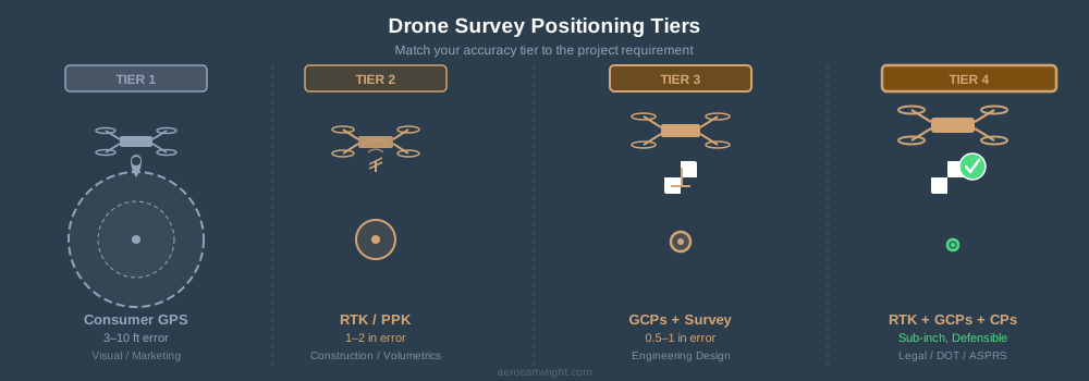
Four positioning tiers for drone surveys: GPS, RTK/PPK, GCPs, and full RTK+GCPs+checkpoints. Match accuracy to the job — not every project needs the top tier.
Tag Archive
3 articles on RTK. Field-tested methodology from a GIS scientist with M.S. GIS, FAA Part 107, and 10+ years of geospatial work.
Four positioning tiers for drone surveys: GPS, RTK/PPK, GCPs, and full RTK+GCPs+checkpoints. Match accuracy to the job — not every project needs the top tier.
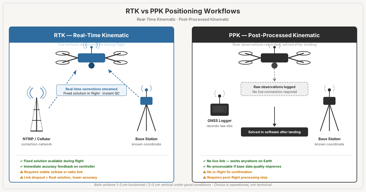
RTK vs PPK for drone surveys: both hit 1-3cm accuracy. RTK corrects in real time, PPK processes post-flight. Failure modes, costs, when to use each.
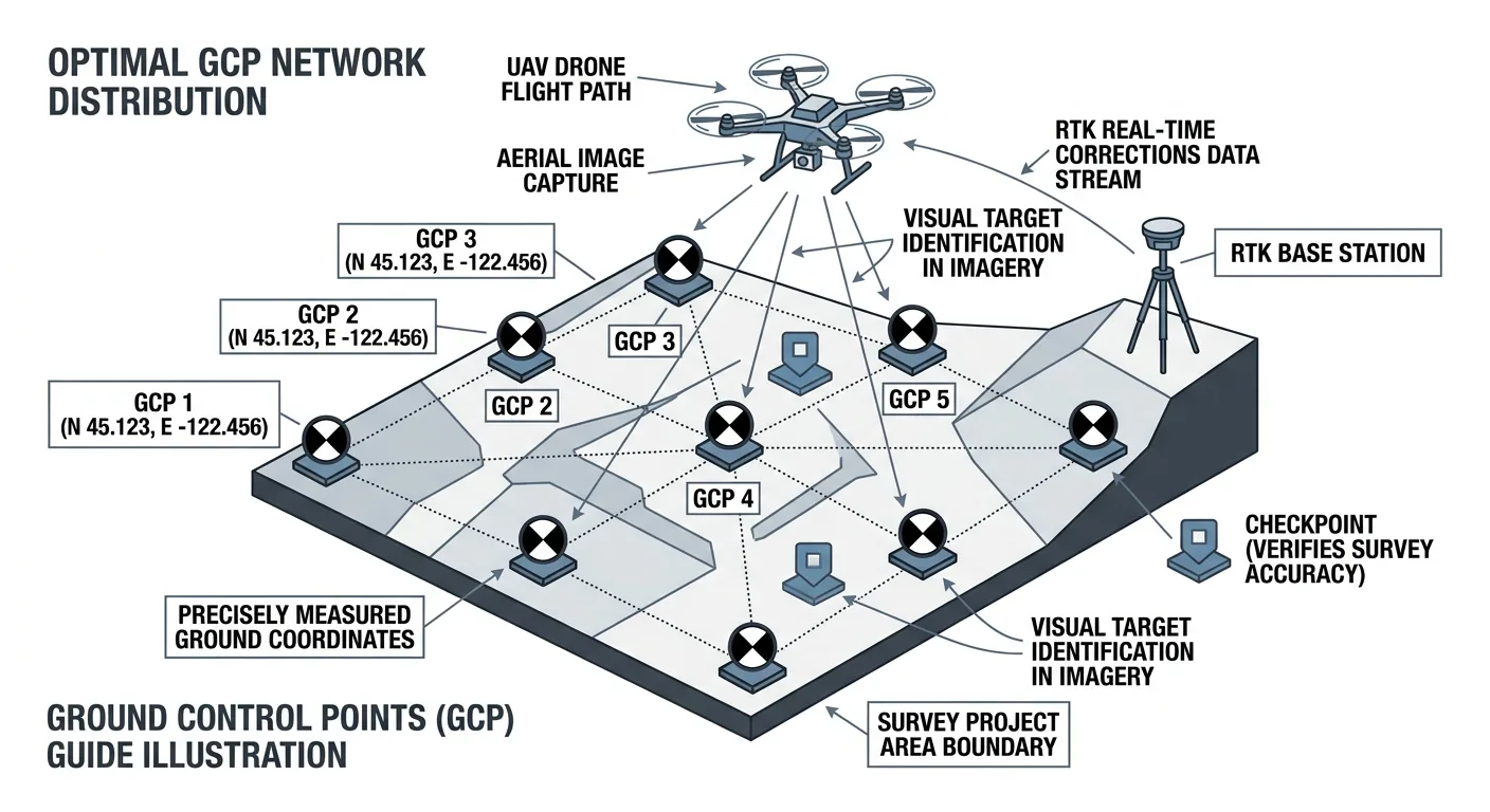
How many ground control points does a drone survey need? 5 GCPs for under 5 acres, 8–12 for 50–500. Distribution beats density — and always include independent checkpoints.
Free download: The Complete Drone Mapping Workflow Guide — 30+ pages of field-tested methodology.
Technical content only. Unsubscribe anytime.