


Legal Disclaimer: This article is for general informational purposes only. Surveying laws and licensing requirements vary significantly by state and are subject to change. Nothing here constitutes legal advice. Before making business decisions about the services you offer or the deliverables you produce, consult a licensed attorney in your state and review your state surveying board’s current rules and formal opinions. When in doubt, contact your state board directly — most publish guidance and will respond to written inquiries.
The Cease-and-Desist That Changed a Business
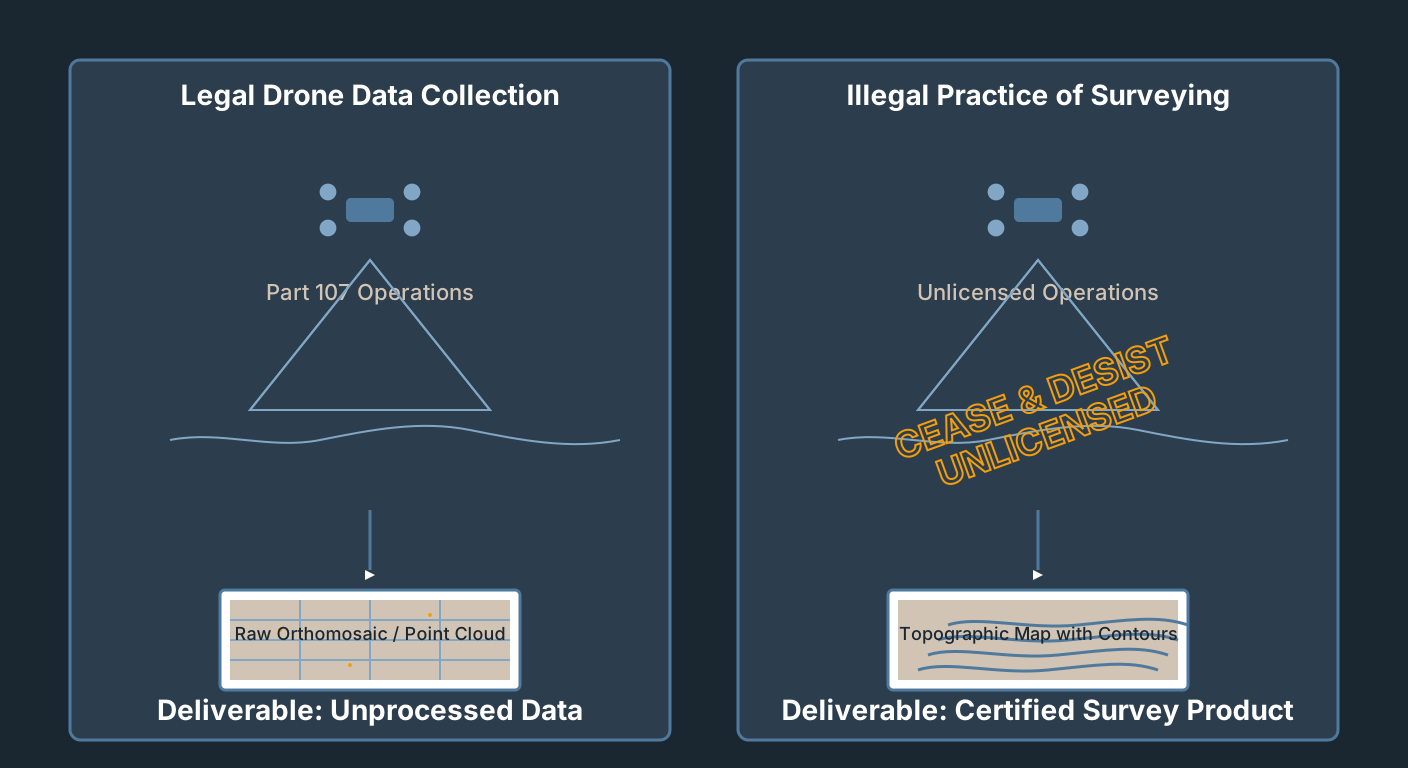
A drone operator in the Carolinas — call him Marcus — had been running a thriving aerial mapping business for three years. Part 107 certified, current insurance, clean record. Construction site documentation, stockpile volumes, progress photography. His clients started asking for more. A residential developer wanted topographic maps with contour lines for a subdivision layout. Marcus delivered. The maps looked right. The contours were clean. The data was accurate.
Six months later, a letter arrived from the state surveying board. Cease-and-desist. His website described his services as “survey-grade topographic mapping.” His deliverables — specifically the DXF contour files he handed off into a civil engineering CAD workflow — triggered the inquiry. The board’s position: he had engaged in the practice of surveying without a license.
Marcus was not flying illegally. His FAA authorization was perfect. The FAA does not regulate what you do with the data after the aircraft lands.
This plays out more often than the drone mapping industry acknowledges. The technical skills to fly a mapping mission and the legal authority to call yourself a surveyor are two completely different things, and the gap between them has real consequences. The Fourth Circuit upheld North Carolina’s enforcement on intermediate-scrutiny grounds in 360 Virtual Drone Services LLC v. Ritter, 102 F.4th 263 (4th Cir. 2024); the Supreme Court denied cert on April 20, 2026 (No. 24-279, official docket), leaving state boards on firm constitutional footing to police unlicensed drone surveying.
What Part 107 Actually Authorizes
Be direct about what your Remote Pilot Certificate is and is not.
Part 107 is an FAA airspace authorization. It certifies you understand the National Airspace System, can operate a small unmanned aircraft safely within it, and have met the FAA’s knowledge requirements for commercial UAS operations. The FAA’s own language: it “demonstrates that you understand the regulations, operating requirements, and procedures for safely flying drones.”
That is the entire scope. The FAA regulates airspace. It does not regulate professional practice. It does not define what constitutes surveying, does not determine who can legally survey, and has no authority over the deliverables you produce or the services you offer after the aircraft lands. Those questions belong entirely to the states.
Part 107 does not:
- Authorize you to practice surveying in any state.
- Authorize you to produce legal survey documents — boundary surveys, plats, ALTA surveys, legal descriptions.
- Authorize you to hold yourself out as a surveyor in marketing, proposals, or contracts.
- Override any state licensing requirement for professional practice.
This is a common and expensive misconception. Drone operators who have invested significant time and money in their Part 107 sometimes assume it gives them broad commercial authority. It gives them airspace authority. The practice question is separate, and it is answered by fifty different state legislatures and their surveying boards.
For the broader picture of what Part 107 means in day-to-day operations, see You Are a Professional Pilot. Act Like One.
What “Surveying” Means Legally
Every state has a statute defining the practice of land surveying, and most are structurally similar. The core elements that appear in nearly every state definition:
Boundary determination. Establishing, reestablishing, or locating property boundaries, corners, or lines. The historical core of surveying — determining where one person’s land ends and another’s begins.
Legal documents and plats. Preparing maps, plats, descriptions, or other documents used for legal purposes — recorded with a county, attached to a deed, used in litigation, or filed with a government agency.
Public safety applications. Surveys used to establish grades, elevations, or alignments for construction, public works, or structures where public safety is implicated.
Holding out. The sleeper clause. Most state statutes also prohibit offering survey services without a license, regardless of whether you actually perform them. Advertising “surveying,” using words like “survey-grade,” or describing your deliverables in terms that imply licensed surveying practice can trigger the licensing requirement before you do any work.
The federal definition is notable for what it does not do: there is no federal licensing of land surveyors. The Bureau of Land Management runs its own cadastral survey program for federal lands, but private-sector surveying is regulated entirely at the state level. The federal government sets no minimum floor — each state draws its own lines.
In practice, whether a drone operator’s geospatial data collection crosses into the practice of surveying turns on the same variables state boards keep returning to: deliverable type, claimed accuracy context, and whether the output will be used for legal or regulatory purposes. Neither NSPS nor ASPRS has published a formal position statement resolving this generally — the analysis is state-by-state, driven by each board’s own statute and opinions, not a national industry consensus.
Industry practice generally treats aerial photography and photogrammetric data processing as distinct from licensed surveying practice — a framing consistent with the ASPRS (American Society for Photogrammetry and Remote Sensing) Positional Accuracy Standards for Digital Geospatial Data, Edition 2 (adopted 2023), which is a technical accuracy standard rather than a legal-scope determination. Producing outputs that substitute for licensed survey products, or that are represented as having legal survey authority, is where the licensing question becomes live.
The Bright Lines: What Always Requires a PLS
Some deliverables are off the table without a Professional Land Surveyor’s stamp. No meaningful gray zone. These are clearly within the practice of surveying in all fifty states.
Boundary surveys. Any work that establishes, reestablishes, or describes a property boundary requires a PLS. Full stop. Boundary staking, boundary location reports, surveys attached to deeds, any document that purports to locate property lines. A drone can fly the property. The drone operator cannot certify the boundary.
Plats and subdivision maps. If it is going to be recorded at the county recorder’s or register of deeds, it requires a PLS stamp. Subdivision plats, lot splits, condominium plats — all require licensed survey work before recording.
ALTA/NSPS Land Title Surveys. These are the surveys required by title insurance companies for commercial real estate transactions. Produced under the joint ALTA/NSPS Minimum Standard Detail Requirements and require a PLS. An unlicensed drone operator cannot produce an ALTA survey. Period.
Legal descriptions. Preparing a metes-and-bounds description or any other written legal description of a parcel requires a PLS in virtually every state. The legal description defines the property for all future purposes. It is a legal document, not a technical output.
Elevation certificates. FEMA elevation certificates for flood insurance compliance must be completed by a licensed land surveyor, registered engineer, or architect. Drone operators cannot sign elevation certificates regardless of the accuracy of their elevation data.
Construction staking for boundary-proximate work. When construction staking establishes building setbacks, easement lines, or right-of-way limits — work tied to property boundary determination — it requires a PLS.
The Gray Zone: What’s Genuinely Contested
Here the law gets genuinely complicated, and where you need to pay close attention to your specific state.
Topographic surveys. The most common gray area. A topographic survey depicts terrain — contours, elevations, surface features — without making boundary determinations. In many states, topographic mapping for general engineering or design purposes is not regulated as surveying practice. The analysis depends on (a) what the topo will be used for, (b) whether it will be used in a permit application or regulatory filing, and (c) how you represent it to the client.
A topo used for internal site planning — never filed, never used to locate a boundary — is generally lower risk. A topo submitted to a local government as part of a grading permit application is a different matter. Multiple state boards have issued opinions that topographic surveys submitted to government agencies require licensed oversight.
Volume calculations. Stockpile volume reporting is one of the fastest-growing drone mapping applications and one of the most legally unsettled. Some states have issued opinions that volume calculations for construction or mining purposes constitute surveying practice. Others have not addressed it. The risk factors: whether the volumes appear in regulatory filings, contracts, or legal documents; whether they are used to settle payment disputes; and whether your marketing language creates an expectation of survey-grade accuracy.
As-built documentation. Post-construction documentation for internal client use — confirming that grading was executed as planned, for example — is generally lower risk. As-builts filed with a government agency as part of a permit closeout are higher risk. Rule of thumb: if the document is going somewhere official, the licensed-practice question becomes live.
Corridor mapping and infrastructure inspection. Collecting data along a utility corridor, road, or pipeline for maintenance or inspection is generally not considered surveying. When that data is used to produce deliverables that drive right-of-way determinations or infrastructure permitting, the analysis changes.
“Survey-grade” accuracy marketing. Not a legal category. A marketing term that has become a legal landmine. Using “survey-grade” to describe your work or your equipment implies your deliverables carry the accuracy and legal authority of licensed survey work. Several state boards have issued opinions or enforcement actions based partly on how operators described their services. Using “survey-grade” when you are not a licensed surveyor is an invitation for scrutiny.
The “Holding Out” Trap
Most drone operators focus on what they are doing. The “holding out” doctrine says you can create legal exposure based on how you describe what you are doing.
State surveying statutes do not just prohibit unlicensed surveying — they prohibit the unlicensed practice of surveying, which includes offering or representing yourself as capable of providing survey services. The practical implications:
Website language matters. “Topographic surveys,” “survey-grade mapping,” “precision surveys,” “land surveys” — any of these may amount to holding yourself out as a surveyor regardless of what you actually deliver. State boards monitor websites. The North Carolina board’s 2018 cease-and-desist to Michael Jones / 360 Virtual Drone Services — the same underlying dispute that produced the Ritter case above — investigated him for the unlicensed practice of land surveying over his advertised aerial mapping services.
Proposal and contract language matters. If your proposal describes the work as a “topographic survey” or uses language that implies licensed survey services, that language can be used against you.
Email and marketing copy matter. Social media posts describing your work as “surveying,” job descriptions using survey terminology, or any public representation that you provide survey services can contribute to a holding-out finding.
What to say instead. You collect geospatial data. You produce orthomosaics, point clouds, digital surface models, and terrain models. You provide aerial mapping and photogrammetric data collection services. The data you produce can be used by licensed surveyors to support their professional services. You do not practice land surveying.
This is not semantics. It is the actual legal distinction between regulated and unregulated practice.
State-by-State Landscape
The table below summarizes the regulatory posture of key states based on surveying board opinions, statute language, and documented enforcement activity. This is a framework, not comprehensive legal advice. Always verify current rules with your state board before operating.
| State | Topographic Mapping | Volume Calculations | Position | Notes |
|---|---|---|---|---|
| Texas | Gray zone — statute doesn’t name photogrammetry or drones explicitly (Tex. Occ. Code § 1071.002(6)) | Not specifically addressed; high scrutiny if in contracts | General enforcement authority; no documented drone-specific action found | TBPELS enforces the state’s surveying act broadly but has published no drone-specific opinion; TSPS has addressed drones only in member commentary, not formal board guidance |
| Florida | Photogrammetry is, by definition, within the practice of surveying and mapping — no separate photogrammetrist license track (Fla. Stat. § 472.005(8)) | Within statutory practice when tied to surveying/mapping outputs | Statute explicitly covers photogrammetry | § 472.005(8): “‘Photogrammetrist’ means any person who engages in the practice of surveying and mapping using aerial or terrestrial photography or other sources of images” — requires the general PSM license; one of the most explicit statutes in the country |
| California | Statute is broader than commonly assumed — Cal. Bus. & Prof. Code § 8726(a)(2) defines land-surveying practice to include determining “the configuration or contour of the earth’s surface… by applying the principles of mathematics or photogrammetry” — a standalone clause independent of boundary determination | Not specifically addressed | Statute covers topo/photogrammetry directly; no board guidance found either way — verify before assuming low risk | Don’t assume topo-only work is safe in California on the theory that only boundary work is regulated — the statute reads more broadly than that |
| Colorado | Statute centers on boundary determination and PLSS corner restoration; no photogrammetry/topographic clause (C.R.S. § 12-120-302) | Not addressed | Relatively liberal on statutory text; no board guidance found either way | Genuinely narrower than California’s on the statute’s face; verify current board opinions before relying on this posture |
| North Carolina | Active litigation history; broad view of “survey” | Volume calcs in regulatory filings = licensed practice | Most active — the only state with appellate case law on point | Per Institute for Justice, which litigated Ritter, the NC Board has issued at least six cease-and-desist letters to drone operators since 2018 over mapping, photogrammetry, and stockpile-volume deliverables; NCBELS has not published its own public enforcement log independently confirming that count |
| Georgia | Aerial photogrammetry expressly within practice for boundary, easement, and ROW work (O.C.G.A. § 43-15-2) | Scrutinized when tied to boundary/easement/ROW determinations | Statute explicitly covers photogrammetry | § 43-15-2 expressly includes “aerial photogrammetry, geodetic positioning systems, land information systems” within the practice of land surveying — verbatim statutory language |
| Oregon | Topographic mapping named as a licensure-infraction risk area (ORS § 672.007) | Volume/quantity computation also named as an infraction risk area | Board has published explicit UAV guidance; no documented public enforcement action found | OSBEELS’s UAS & Land Surveying Regulations brochure explicitly lists “Topographic mapping” and “Volume computation” among potential infractions for unlicensed UAS operators |
| Washington | Broad statutory definition covers topographic surveys and mapping (RCW § 18.43.020(7)) | Scrutinized in regulatory context | Posture unclear — no official Board guidance on UAV mapping found, no documented enforcement action | The state Board of Registration for Professional Engineers and Land Surveyors has published no drone-specific guidance; informal discussion exists only in the private Land Surveyors’ Association of Washington’s newsletter, not from the Board itself |
| Arizona | Platting/subdividing land is defined by statute as land-surveying practice, not engineering | Not specifically addressed | Mostly clear — one statutory exception | A.R.S. § 32-101(22)(c) defines “land surveying practice” to include “platting or plotting of lands for the purpose of subdividing.” Engineers may perform only the surveying in § 32-101(22)(d)–(e) (measurement/topographic work, construction staking) per § 32-101(11); landscape architects are separately barred from cadastral surveys and final plats under § 32-101(21). Exception: A.R.S. § 9-474(D) lets a registered civil engineer, not just a land surveyor, prepare and attest certain subdivision plats for unincorporated land near city/town limits. No Arizona case law found on this boundary as applied to drone-collected data |
| New York | Broad statutory definition (N.Y. Educ. Law § 7203); a private professional-society technical standard reads it to reach remote-sensing methods | Within practice of surveying when measured by direct or remote sensing, per industry technical standards | Statute is broad; unlicensed practice is a Class E felony | NYSAPLS’s Minimum Technical Standards (a professional-society document, not NY State Education Department guidance) states surveys “measured by direct or remote sensing methods, which would include drone mapping” fall within practice; unlicensed practice is a Class E felony under § 6512(1) |
For states not on this list: Read your state’s surveying statute — specifically the definition of “practice of surveying” and the exemptions. Then look for any board opinions or guidance documents on photogrammetry, UAV data collection, or topographic mapping. Many state boards have formal opinion processes — submit a written request and get an official response. That response becomes your safe harbor if it’s ever challenged. State and local rules also touch on where you can fly in the first place; see State and Local Drone Restrictions That Surprise Experienced Pilots for the airspace side of the same problem.
Safe Harbor Strategies
“Gray zone” does not mean “do whatever you want and hope for the best.” It means the risk level depends on how you operate. Here is how to operate in the gray zone with reduced exposure.
Limit your deliverables to visual outputs. Orthomosaics, aerial photography, 3D mesh models for visualization — the lowest-risk deliverables. You produce an image product, not a survey product. Risk escalates as you move toward georeferenced point clouds, contour-line DXFs, and engineered grade data.
Be explicit about what your deliverables are not. Contract language should state that the data is photogrammetric mapping data only, that it has not been produced under the supervision of a licensed land surveyor, that it should not be used as a substitute for licensed survey work, and that it is not suitable for establishing property boundaries, preparing legal descriptions, or any purpose requiring a licensed survey.
Do not touch regulatory filings. If the deliverable is going to a government agency as part of a permit application, regulatory filing, or any official record — that is the moment to involve a licensed PLS. Your data can still support that work, but the licensed professional takes responsibility for the work product.
Know the intended use before you accept the job. “What is this data going to be used for?” is not intrusive. It is necessary. If the client intends to submit your topo to the county planning department for a grading permit, that is different from using it internally for design decisions. Ask. Document the answer.
Avoid the accuracy claim trap. Describe your equipment’s technical specifications (RTK, 1.5 cm GSD, sub-5 cm vertical accuracy) without claiming survey-grade authority. The specs are objective. “Survey-grade” is a representation about professional standing you do not have.
For the scope of what those measurable specs actually mean in practice, see Drone Survey Accuracy: What “Centimeter-Level” Really Buys You and the Ground Control Points for Drone Surveys field guide.
Working Under a PLS: What That Actually Looks Like
The most legally defensible model for drone operators who want to work in survey-adjacent territory is to operate under the supervision and professional responsibility of a licensed PLS.
This is not a paperwork workaround. It’s a genuine professional relationship with specific requirements.
The PLS must exercise responsible charge. Most state statutes require that licensed work be performed by or under the direct supervision of the licensee, who must exercise “responsible charge” — meaning actual knowledge of and professional responsibility for the work. A PLS who lends their stamp to work they did not supervise is committing professional misconduct. This is real exposure for both the PLS and the drone operator.
What genuine supervision looks like. The PLS reviews the project parameters, establishes the control network (or reviews the GCPs you collected), reviews the deliverables before they go to the client, takes professional responsibility for the accuracy representations in the final product, and signs and stamps the output. Not a rubber stamp — the responsible professional.
Subcontractor relationships. Many drone operators work as technical subcontractors to surveying firms. The drone operator collects the data. The surveying firm processes it, reviews it, and issues the survey products under the PLS’s seal. This is entirely legal and is how the industry increasingly operates on large infrastructure, construction, and land development projects.
Profit margin implications. Operating as a subcontractor to a PLS means you do not capture the full project value — the surveying firm does. But your legal exposure drops dramatically, your deliverables have professional standing, and you build relationships with firms that will generate repeat business.
Get the relationship in writing. Whatever the arrangement — subcontractor agreement, professional services agreement, formal employment — document it. The agreement should specify who bears professional responsibility for the work product, what supervision will be exercised, and what your role is limited to (data collection, processing, etc.).
For the broader risk picture this fits inside, see Drone Mapping: It’s All About Risk.
Insurance and Contract Liability: The Part Nobody Talks About
There’s a scenario that gets less attention than state board enforcement but carries equal financial risk: the client who uses your deliverables for a legal purpose, has a problem, and sues you.
If you deliver a topographic map without a PLS stamp, the client uses it for a grading permit, the grading causes a downstream drainage problem, and there’s litigation — your contract will matter enormously. The question will be: did you represent that your deliverables were suitable for the use the client made of them? If your contract language is loose, or if your proposal described the work as a “topographic survey,” you may find yourself arguing that your deliverables were not suitable for the very use you accepted money to enable.
Professional liability (E&O) insurance for geospatial and mapping services typically requires that you operate within your licensed scope of practice. If you produce deliverables that arguably cross into licensed surveying practice, your E&O carrier may argue the loss is outside your covered services. Verify with your carrier what your policy covers — and more importantly, what it excludes.
Contract language is your first line of defense. State clearly what you are providing (aerial mapping data, photogrammetric outputs), what you are not providing (licensed survey services, PLS-stamped deliverables), and what the data should not be used for without licensed survey review. This will not insulate you from everything — but it establishes the scope of what you agreed to deliver.
Practical Checklist: Before You Take the Job
Run through this before signing any contract that involves mapping deliverables.
Deliverable assessment:
- Is the client asking for a boundary survey, legal description, plat, or ALTA survey? Stop. This requires a PLS. Refer out or partner.
- Is the client asking for an elevation certificate? Stop. Requires licensed engineer, surveyor, or architect.
- Will this deliverable be recorded at a county office or attached to a deed? Stop. Requires PLS stamp.
- Will this deliverable be submitted to a government agency as part of a permit or regulatory filing? High risk. Consult your state board or involve a PLS.
Use-of-data assessment:
- Does the client intend to use this data to establish property boundaries or resolve a boundary dispute? Off limits without PLS involvement.
- Will this data be used in litigation? High risk. Get an attorney’s opinion on whether licensed survey work is required.
- Is this for internal planning or design use only, never filed with any government agency? Lower risk. Proceed with appropriate contract language.
Marketing and contract language review:
- Does your website or proposal use the words “survey,” “surveying,” or “survey-grade” to describe this work? Revise to “aerial mapping,” “photogrammetric data collection,” “terrain modeling.”
- Does your contract contain a clear statement of scope and a clear limitation on what your deliverables should not be used for? If not, add it before signing.
- Have you confirmed your E&O insurance covers the work as scoped? Call your broker if you’re unsure.
State compliance:
- Do you know your state’s surveying statute and any board guidance on UAV mapping? If not, look it up before this job — not after.
- Is this a state with documented enforcement history (NC) or an explicit statute/board guidance naming photogrammetry, remote sensing, or UAV mapping (FL, GA, NY, OR, CA)? Extra caution warranted.
Bottom Line
Your Part 107 certificate makes you a federally licensed remote pilot. It does not make you a licensed land surveyor. Different credentials, different authorities, different legal frameworks — and operating as if they’re the same thing is how you end up with a cease-and-desist letter or a lawsuit.
The drone mapping industry sits in a genuinely complicated legal space. Some of what we do is clearly outside the practice of surveying. Some of it is clearly inside it. A lot of it falls in between, where your risk depends on the deliverable type, the intended use, your marketing language, and the state you’re operating in.
The professional move is to understand that distinction clearly and to build your business model around it. Know what you can legally deliver. Know what requires a PLS. Position yourself as the data collection specialist, not the surveyor. Build relationships with PLS firms who need your capabilities. Use contract language that accurately describes your scope.
That is not a limitation. That is knowing your lane — and operating in it without apology.
Additional Resources:
- Your state’s professional surveying board (find via the NCEES member board directory)
- NSPS (National Society of Professional Surveyors)
- ASPRS (American Society for Photogrammetry and Remote Sensing)
- FAA Part 107 rules
- NCEES (National Council of Examiners for Engineering and Surveying)