Photogrammetry
Metashape Processing Settings: What Each One Actually Does
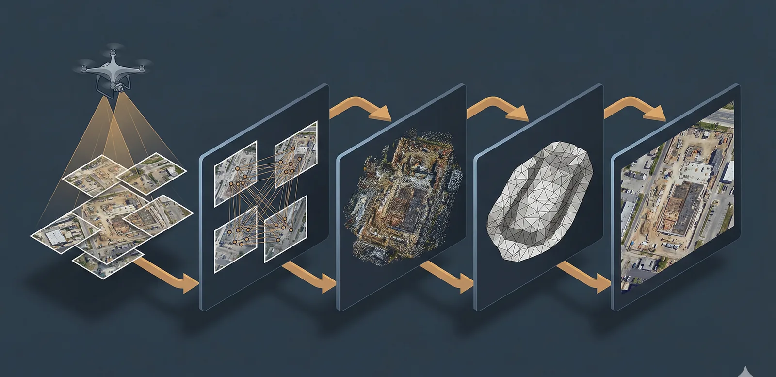
A practitioner's guide to Agisoft Metashape processing settings: what each quality slider controls, why the tradeoffs matter, and three presets for real jobs.
Read more →