
Data Processing
Processing Checklist: From Raw Images to Defensible Deliverables
Drone processing checklist: CRS setup, alignment QA, GCP integration, checkpoint validation, quality report review. Prevents accuracy failures.
Read more →
Tag Archive
6 articles on checklist. Field-tested methodology from a GIS scientist with M.S. GIS, FAA Part 107, and 10+ years of geospatial work.
Drone processing checklist: CRS setup, alignment QA, GCP integration, checkpoint validation, quality report review. Prevents accuracy failures.
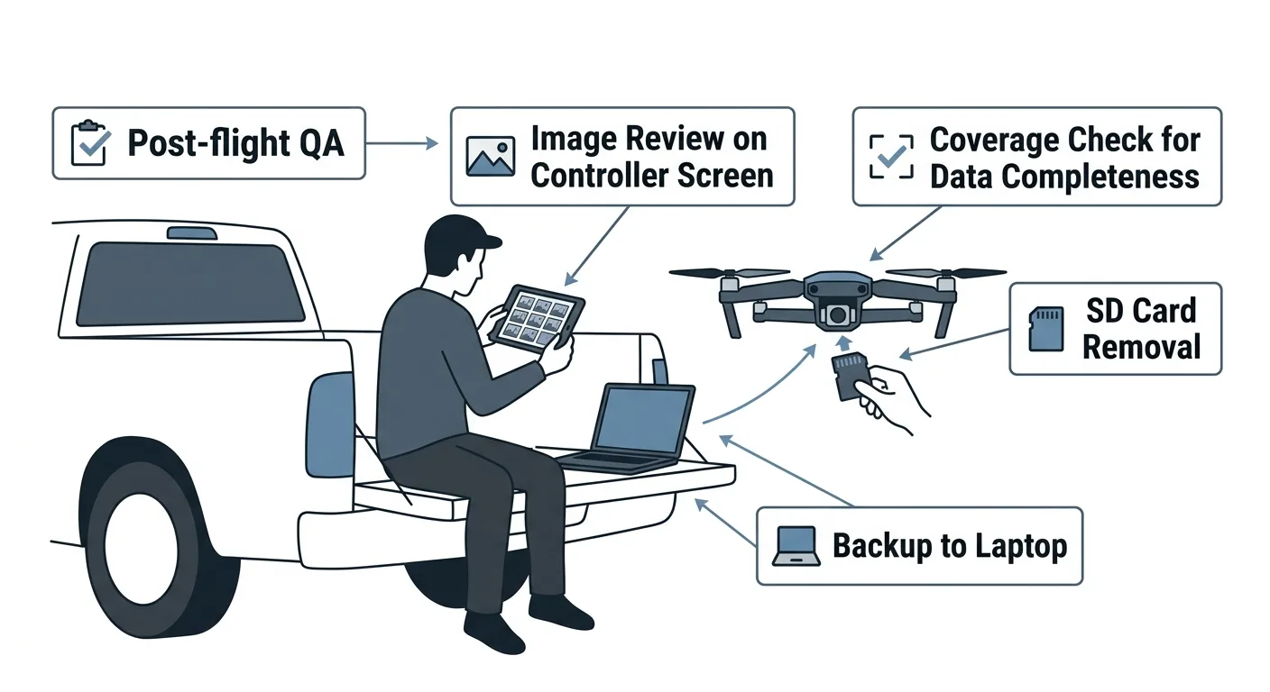
Post-flight QA checklist: image review, coverage verification, metadata validation, 3-2-1 backup. Part 4 of the drone mapping checklist series.
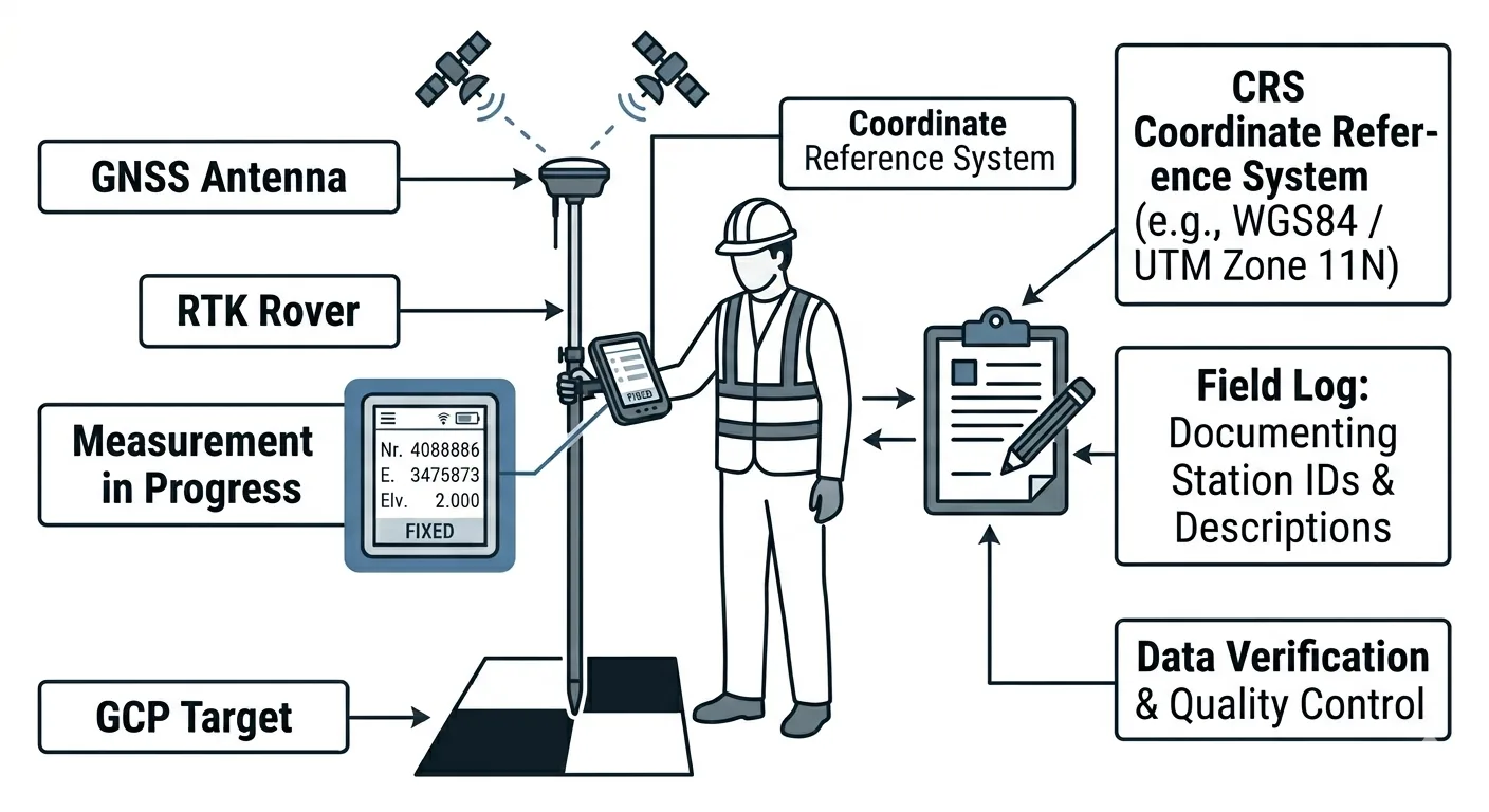
GCP deployment checklist: placement, measurement procedure, photo documentation, field logging. Every step from planning through pre-flight.
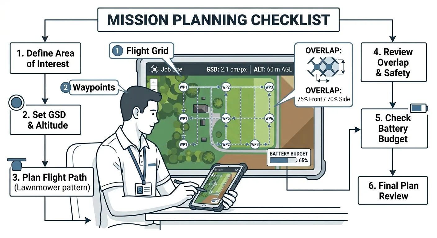
Altitude, GSD, overlap, battery budget — the four parameters that decide whether drone mapping data is usable. Mission planning checklist for surveyors.
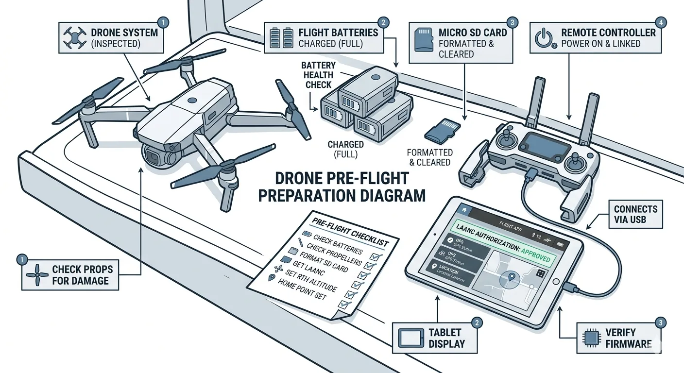
Pre-flight checklist for drone surveys: airspace verification, weather assessment, equipment inspection. Part 1 of the 7-phase drone mapping checklist series.

Six-phase drone mapping checklist from pre-flight to deliverable handoff. Based on aviation protocols — prevents costly reflys and data rejection.
Free download: The Complete Drone Mapping Workflow Guide — 30+ pages of field-tested methodology.
Technical content only. Unsubscribe anytime.