Data & Deliverables
What Is Drone Data?
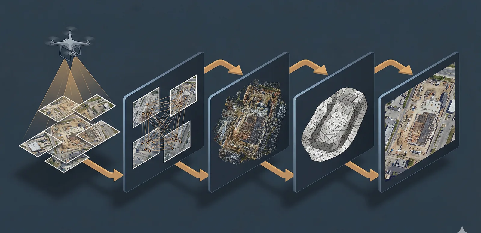
Drone data explained: imagery, orthomosaics, point clouds, elevation models, 3D meshes. How photogrammetry turns photos into geospatial products.
Read more →
Tag Archive
1 article on 3D mesh. Field-tested methodology from a GIS scientist with M.S. GIS, FAA Part 107, and 10+ years of geospatial work.
Drone data explained: imagery, orthomosaics, point clouds, elevation models, 3D meshes. How photogrammetry turns photos into geospatial products.
Free download: The Complete Drone Mapping Workflow Guide — 30+ pages of field-tested methodology.
Technical content only. Unsubscribe anytime.